
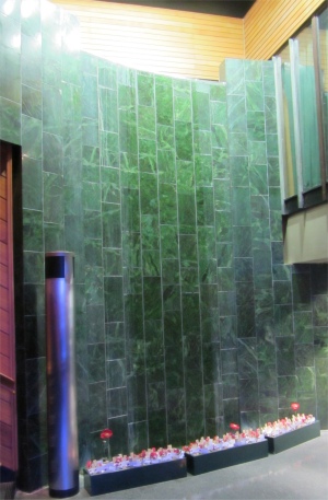
 "Tears on Greenstone", Wall of Remembrance |
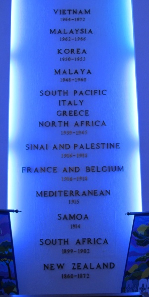 Conflicts New Zealand has Been Involved In |
I headed out of Napier in a westerly direction, leaving the sign saying no fuel for 139km behind me, to cross over the Inland Patea Route, passing in between the Kaweka and Ruahine Ranges. It was a long, convoluted route taking hours, and the habitation up in these remote areas was zilch. The high sections were swathed in low, dense cloud severely reducing visibility. I pulled in at a gravel stockpile location in order to stretch my legs, and was confronted with the stomach, intestines and various other organs of a large beast sitting in a fresh pool of blood. Whoever had recently butchered the animal here didn't have the decency to clear up the mess left behind.
Waiouru, at the junction of SH1 and SH49, was my first encounter with a settlement of any size after the crossing between the ranges. It was the last chance for fuel for those travelling due north along the Desert Road through the Rangipo Desert. And being on the verge of an exposed and barren desert, this bleak tussock plain was an ideal place to set up a major army base. In the National Army Museum based there, I came across the Roimata Pounamu, or "Tears on Greenstone", wall of remembrance. This was heavily symbolic: a curving wall of greenstone tiles being cleansed by the "tears of mourning" water running down over its surface. The heart strings were simultaneously tugged by a recorded voice reciting the name, rank and place of death of each of the 33,000 New Zealanders who had died in the various wars, from the New Zealand Wars of the 1860s, through Gallipoli in World War I, World War II, and finally the Vietnam War. Very moving, and such a tragic waste.
On a lighter note, a section of the museum showed the importance of rugby to the Kiwi troops in boosting morale. It was played between different divisions and also countries during the various theatres of war. A recorded interview gave an account of a game between the Kiwis and the French Light Infantry at Monte Cassino, where it was stressed that the game was unusual in that no kicking took place. It was revealed that no ball was available, so they were using a dead fowl.
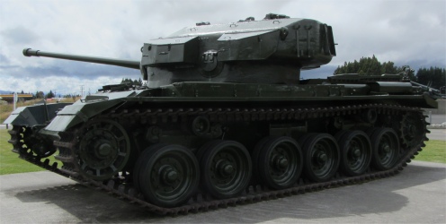 Centurion Tank |
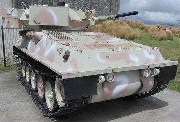 Scorpion CVR |
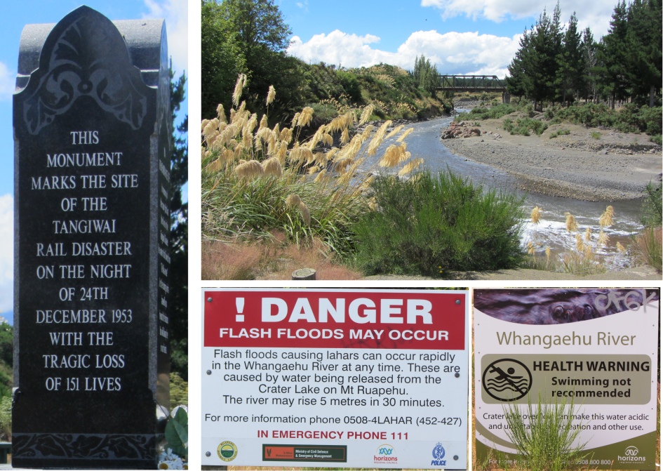 Tangiwai Memorial, with Todays Rail Bridge and Some Modern Warnings |
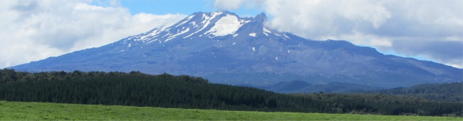 Mount Ruapehu |
 Ohakune Carrot |
I continued my route east along the southern edge of the Tongariro National Park, passing through Ohakune on the way. The small town primarily served the skiing fraternity, but was also at the heart of one of the nation's prime market gardening regions, in particular the area produced two thirds of the nation's carrots. To emphasise this, a huge, roadside fibreglass carrot welcomed me into the town. At times I got the impression that New Zealand was a slightly reserved country, but this sight turned the whole idea upside down.
Deep, friable and free draining soils coupled with a cool climate and central location make Ohakune ideal for vegetable production, especially carrots. Many of the early growers were Chinese who carried out the arduous task of clearing the cut over bush in exchange for the use of the land for three years to grow in succession cabbage and cauliflower followed by carrots, parsnips or potatoes, after which the field was returned to the farmer for pasture. The growth of towns and cities along the North Island main trunk railway meant more demand for Ohakune's growers and land clearing became easier with the introduction of bulldozers in the 1930s.
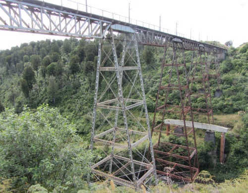 Makatote Viaduct |
After the war the rapidly growing New Zealand population absorbed increasing quantities of vegetables and by the early 1960s the newly formed Ohakune Growers Association had 60 members.
By this time some Chinese families had purchased their own farms and diversified into sheep and cattle while some pastoral farmers entered market gardening to supplement their declining income from wool. Consolidation in the market place from 1970 onwards together with better machinery and technical advances in crop production has meant that in year 2010 there were just 12 production units.
Most of these are family companies producing for 9 months of the year all of the North Island's carrots, swedes, parsnips, brussels sprouts and washed potatoes. These products are also exported to the Pacific Islands and parts of Asia.
I stopped off at the Makatote Viaduct to admire the underpinning on one of the towers. In early 2006, Ontrack took action to counter scouring around the footing of one of the central piers. This involved building two piles beside the existing concrete footing and installing a 38m steel cross beam.
Each pile was created by sinking a 2m casing 25m into the ground, and filling it with concrete and steel reinforcing. The project involved working in extreme weather through the winter of 2006 to build roads and temporary bridges to provide access to the site.
I headed north to the campsite at Whakapapa on the western flank of the national park; what a lovely name. On checking in, I asked the friendly chap in reception about the Tongariro Alpine Crossing - how I could get dropped off at the start and get picked up at the finish, and anticipated weather conditions over the next day or two.
"Busses leave at 7, 8 and 9am, and will pick up at the other end at 3, 4 and 5pm. The transportation charge will be $35 for both trips, and you can pay up front or later. Don't even think about doing the crossing until you have a weather report. We open up at 8am, but the driver for the 7am bus will have a report," was the response. "It was hosing it down here this morning, but you can see now we have some sun, so be prepared," he added.