My bags had been packed a couple of days earlier, the only thing left to do was to throw in my trainers, lock the front door and go. To my horror I found that a hole had appeared in the side of one of my trainers. I had been using them a lot for cycling recently, and the constant rubbing of a toe strap had caused the damage. A quick trip into town for replacements rectified the situation.
Soon I was shooting down the A12, observing the outside temperature to be 26 degrees C. We were leaving the UK during a spell of high pressure. The weather was picking up, with a heatwave predicted for the following week.
I found Rex and Meryl as chirpy as usual, and soon we were catching up on news over mugs of tea in the back garden. They had performed all the donkey work on Duonita, getting her shipshape. By late afternoon we had stowed away our luggage on board, and carried out a few maintenance tasks.
Meryl had prepared a delicious roast dinner for us which would serve us in good stead for our North Sea crossing. Very kind of her I thought; perhaps she was mindful of the fact that a year earlier I had neither eaten nor drunk on our crossing of that treacherous stretch of water in "bouncy" conditions.
Rex was itching to get away and by 20:00 we were aboard Duonita again, waiting for the tide to float us. However, it was neap tides, and at high water we were barely floating. Hmmm..... perhaps time for Rex and me to consider our dietary arrangements, or had he packed away too many jars of lime and chilli pickle? The air was filled with the sound of Oyster Catchers noisily gossiping over our predicament, probably taking bets on whether we would actually make it out on this tide. Not wishing to hang around for another 12 hours for an extra 20cm of water, we said our farewells to Meryl, and using a lot of engine brute force, we slowly eased and sucked Duonita out of the sticky, oozing mud, the surrounding waters taking on a rich, dark stain due to the churning sludge. Once free, we turned her nose towards the deeper channel, and we were off on another adventure. Those first few moments after leaving a berth for a brand new adventure into foreign lands always fill me with tremendous excitement and anticipation, a truly magical feeling that I always experience on such trips, and I guess I always will.
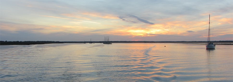
 Heading Out Along the South Channel into a Blue Void on the Start of a New Adventure |
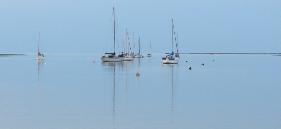
 Farewell Tollesbury |
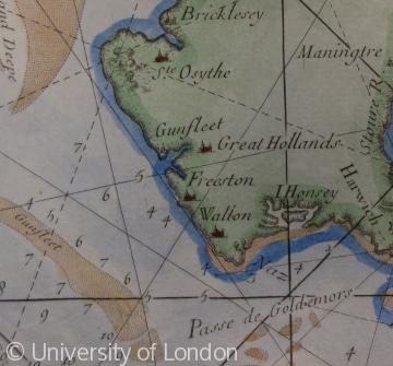 An 18th Century Coastal Chart for Use by Mariners, Probably Copied from Earlier Maps. It Shows the Gunfleet Sands and Estuary, and the Depths of Water (in Fathoms) |
As the former estuary was reclaimed for agriculture from the late 17th century onwards, so the original name was largely forgotten on land and replaced by the name Holland Haven. But off of the coastline the name has been preserved as the Gunfleet Sands into the 21st century.
The romantic name of the Gunfleet Sands is also referred to in Rudyard Kipling's "The Long Trail".
We now started to head up the Kings Channel. Once again I felt at home with the sea, and at the bewitching hour, turned in, leaving Rex to take the first watch.