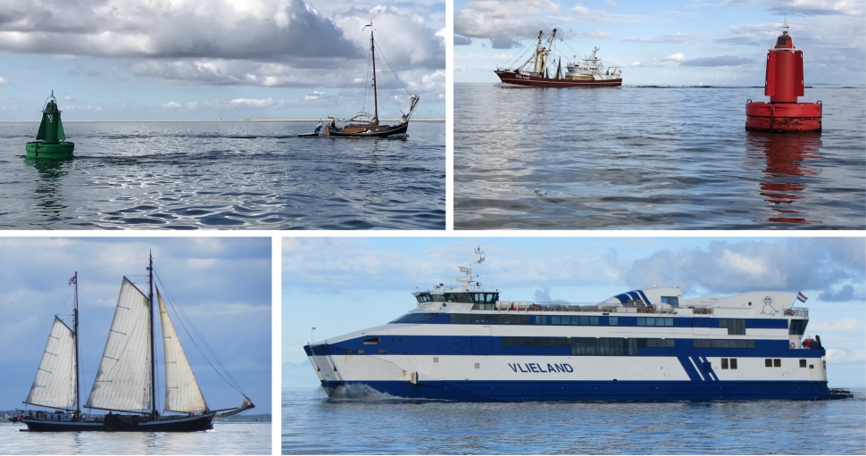
Once out of the lock, we motored past the ferry terminal, with just one solitary person high up on the promenade to wave us off. The rest of Holland slept. Or so we thought. Exiting the Voorhaven, it was like Piccadilly Circus with yachts, fishing boats, ferries and barges scooting along the narrow, winding channels across the Waddenzee.
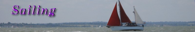
 A Busy Waddenzee |
Towards the North Sea the islands are marked by dunes and wide sandy beaches, and towards the Wadden Sea a low, tidal coast. The region is continually contested by land and sea. The impact of waves and currents carrying away sediments is slowly changing both land masses and coastlines. For example, the islands of Vlieland and Ameland have moved eastwards through the centuries, having lost land on one side and added it on the other.
Despite all the activity, an air of tranquillity presided over this vast watery plain. The sea was quite calm, with vessels silently appearing over the horizon. Harlingen slowly sank beneath its eastern horizon, and the islands of Vlieland and Terschelling slowly rose up from the sea to the west. Those distant landmasses mysteriously sat on thin slivers of silver, as if they were mirages. A seal popped up from the depths, had a good look around while he sniffed the air, then arched his back and brought his tail in the air before sliding below the surface. A coastal patrol vessel kept tabs on us on a few occasions before disappearing off to Vlieland. Rex doesn't do snooping vessels, the air turned blue for a while in both English and Dutch. I just advised him to keep off the pickled herrings.
Tranquility returned, enhanced by a text from my sister-in-law, Jenny, who was thinking of my wife - she would have been celebrating her 67th birthday today.
After an intricate set of manoeuvres over a maze of shallow channels, we entered Vlieland Marina, the narrow entrance being accessed from a vicious tidal crossing perpendicularly.
Again I encountered a jovial harbour master, and soon we were safely and painlessly secured inside a berth. A hot shower was all I required then to make my day.
Rex decided to have a nap. I needed to explore. I espied a high ridge crowned with trees nearby, so I opted to hike up there.
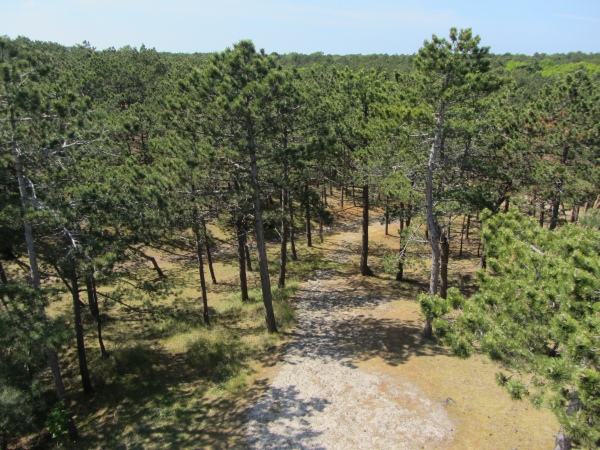 A Maze of Forest Paths |
The island is around 12 km in length and no more than 2 km in width, of which the largest part is a desert-like area in the west, the Vliehors. The island is largely forested, and is an island of dunes, the most prominent being the eye-catching Vuurboetsduin. This is a forty-metre high dune with a red lighthouse (though today a lighthouse covered in tarpaulin) on top.
The island, which is regarded as the most remote from the mainland, has a population of approximately 1100 people and is well known for the beautiful landscape, the large and various bird population and the peacefulness. In summer, many tourists come to visit the island, fortunately none of them are allowed to bring vehicles across to the island.
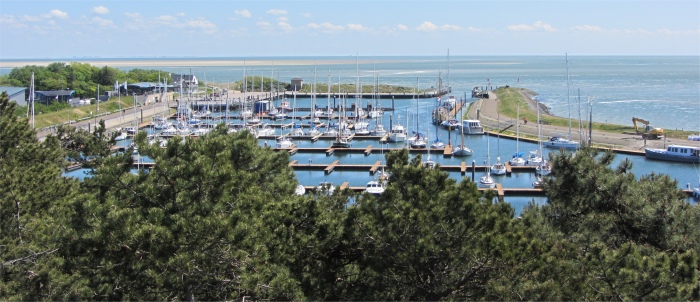 Looking Down on the Marina |
On reaching my vantage point I found an array of well-trodden paths leading in all directions through the forest. Nearby, I noticed a manmade tower which I climbed, and was afforded splendid views over the eastern side of the island. I proceeded to take a hike along the paths, randomly heading into the interior. A mixture of and deciduous trees draped the grassy dunes. It was a wonderful feeling to be hiking on land again, my lungs sucking in the heady, resinous vapours from the conifers.
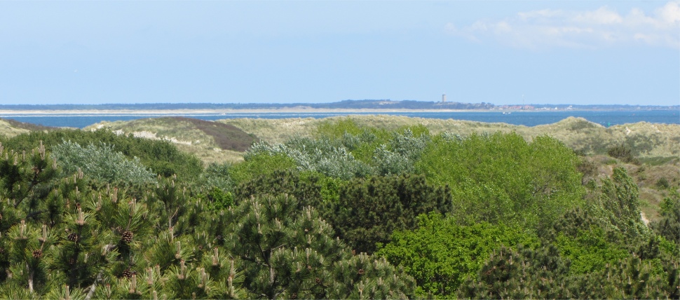 Looking Across to Terschelling in the Distance |
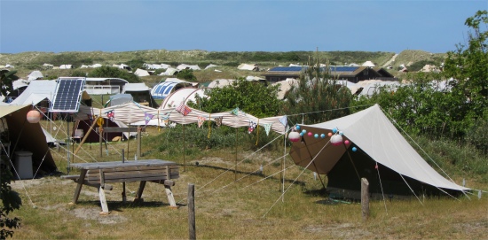 Just One of the Many Campsites |
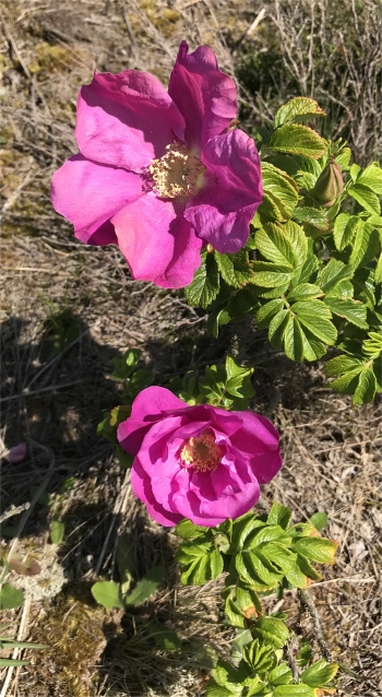 Dog Rose |
On the next table, two blokes and a woman sat. The guys were soon chatting with us in English, and at times in Scottish. The huge, stocky gorilla chap, sporting a black T-shirt and a mass of fuzzy, blond hair above his ruddy face had a mischievous sense of humour. He had once been based in Aberdeen and worked on the oil rigs, and he expressed his fondness for haggis, neaps and tatties, together with black pudding. We learned he was originally married to a Danish woman, but was now married to a Dutch one. "She is a nurse," he stated. "Many women are more concerned with their nails or hair, but nurses look after you," he added. The other chap had been a lorry driver, but was now hobbling about with a crutch. He was a keen motorcyclist, often frequenting the Isle of Man TT Races, but had recently suffered a terrible motorcycle crash. He had smashed his face, losing many teeth and breaking his nose. In addition he had broken an arm and a leg, the latter requiring a metal plate to aid the bone to set. He must also have damaged some nerves since he could no longer taste.
Both were from Vlieland, and spoke Frisian. This was superb for Rex who had studied Frisian on a distance-learning course. They proceeded to give us a crash course in Frisian. Any time a local passed by on their bike they would shout "Hoi,", "Hooi," and various other greetings. The 1100 inhabitants were a close knit community which relied chiefly on tourism.
As they left, they recommended the food inside. As we entered, we discovered it was a restaurant (well with a name like Restaurant de Richel, what else could it be), a popular one too judging by the rate at which tables were filling up. We grabbed a table and enjoyed a splendid meal; slip tongs for me tonight.
As we returned through the town, a ferry arrival was signified by crowds of folk marching by with suitcases, and groups of children being herded onto coaches for transportation to the many campsites.
The evening was warm and fairly still as we strode along the sea wall - the calm before the storm. When we reached Duonita a Force 5 had suddenly appeared from nowhere.