sailing_banner
previous stage ...... next stage ......
Harlingen Leeuwarden

Netherlands Trip - Terschelling      19th June:

terschelling_trawler
Trawler Looking for Fish
    Another cloudless, scorching morning greeted us. Rex exchanged a quick Skype with Meryl before we marched off, or should I say ambled off, to the ferry terminal. Today would be spent on the island of Terschelling.
    Our ferry side-stepped its way across the narrow channels of the Waddenzee, its wake tearing a rip in the turquoise sea which seamlessly joined the turquoise sky. There was no wind, and sailing boats and barges motored up and down alongside the main channels. The tide was ebbing, and a flow of about 1 Knott could be detected flowing past the buoys. Spits, sand and mud magically appeared out of the mirror sea, some of them hundreds of acres in area. Cormorants dived and surfaced, gulls glided effortlessly alongside the ship, and seals popped their heads up to see what all the fuss was about before diving down for a few more tasty morsels.
    The channels into Terschelling were extremely convoluted, at times almost doubling back on themselves. The island of Vlieland drifted close into view, and slowly Terschelling materialised on its eastern side.
    After a brief pause to allow another vessel to leave, we glided effortlessly into port. The harbour side was festooned with cycles belonging to a handful of "Cycle for Hire" outfits. Mountains of luggage littered the area and gaggles of folk stood frantically waving and shouting to family and friends.
approaching_terschelling
Approaching Terschelling      (please use scroll bar)

    Once ashore, we quickly located the VVV, acquired a map, and headed towards the centre of West Terschelling. The island was formed in the Middle Ages from a sandy area called De Schelling in the west and the original island Wexalia in the east. The name Wexalia, Wuxalia, or Wecsile is the medieval name of eastern Terschelling. However, this name disappeared at the end of the Middle Ages. The last appearance of the name Wexalia is in a treaty between Folkerus Reijner Popma, then ruler of Terschelling, with King Edward IV of England in 1482.
    The oldest traces of civilisation on Terschelling date from around 850, when a small wooden church was built on a hill near Seerip or Strip. This hill was later used as a burial ground and is known as the "Striperkerkhof".
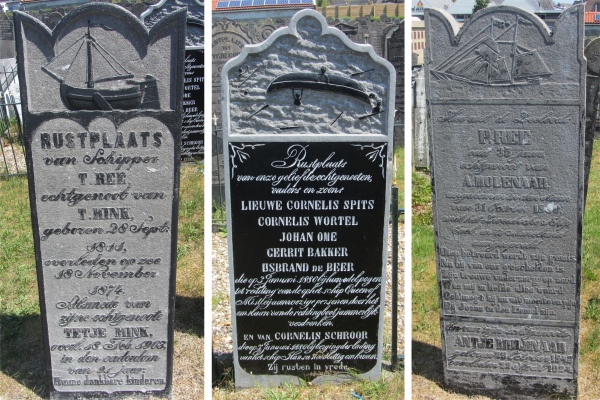
    The Dutch navigator Willem Barentsz, who we came across at the small museum at the port in Harlingen, was born on Terschelling around 1550. Historically, tensions existed between the inhabitants of West-Terschelling, with its strong orientation towards the sea, and the more agriculturally oriented inhabitants of East-Terschelling. In 1612 this led to the division of the island into independent political entities, West-Terschelling and East-Terschelling.
    In 1666 West-Terschelling was ransacked by the English. The English fleet had originally planned to attack the Dutch merchant fleet which was moored before the coast of Vlieland. When the Dutch vessels retreated towards Terschelling, the English followed, destroyed 150 Dutch vessels, and landed in the harbour of West-Terschelling. The town was burnt to the ground by the English on this occasion which would become known as "Holmes's Bonfire" after the English admiral Sir Robert Holmes. The Great Fire of London in the very same year was considered by some to have been God's retribution. The next year, in 1667, the Dutch under command of De Ruyter executed a retaliatory expedition, and dealt the English navy a heavy blow at the Raid on the Medway (also known as the Battle of Chatham), in effect ending the Second Anglo-Dutch War.
    Only after the French occupation at the start of the 19th century, the independent political entities of West-Terschelling and East-Terschelling were once again united as one entity.
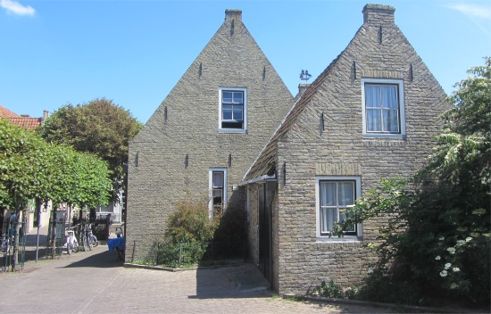
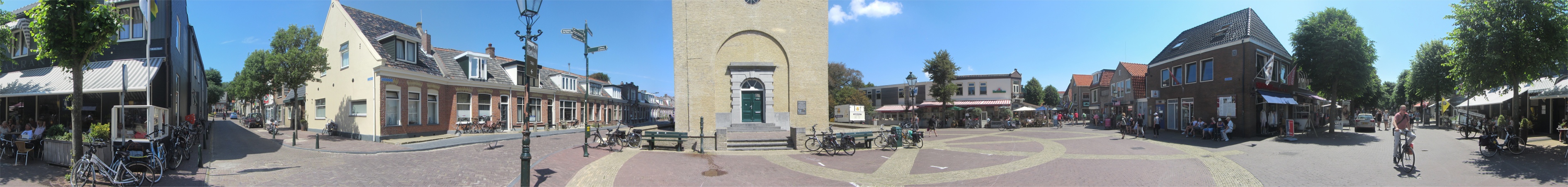
terschelling_houses
Terschelling Houses
    Today the island was crowded, but a week earlier it must have been bedlam due to the ten-day Oerol Festival. Every June, some 50,000 visitors of all ages arrive by the boatload, literally, to view theatre, dance, performance art, live music, installations or simply partake in the communal vibe. Oerol, the word meaning "all over" in the local Frisian dialect, stages professional performances throughout the island - on the street, in barns and, most memorably, in woods, fields, dunes and on the beach. The festival exemplifies site-specific theatre, where art and environment meld, each illuminating the other. Oerol takes its name from an old Terschelling tradition, when for a short time in early spring cattle were allowed to roam freely on the island, grazing on any and all available greenery. The oerol tradition continued until the arrival of paved roads, since cars and bicyclists collided at night with sleeping cattle. It was finally ended during the German occupation of the island in World War II.
    As we made our way into West-Terschelling, we passed by an art dealer's, and Rex instantly fell in love with a painting in the window. We entered and browsed through a large collection of seascapes and maritime paintings. Rex was keen to get a feel for the prices of these artworks, and acquired the price list. He did not seem to flinch at the price of the painting that was dear to his heart, though I feared Meryl would.
    We fell into conversation with the lady who owned the shop. "I originally owned a gallery on the mainland," she told us, " which I ran for twenty years. Then I discovered Terschelling, and then this corner building which I converted into my new gallery. I have been here for five years now, and have never regretted it."
terschelling_main_square
Terschelling Main Square      (please use scroll bar)

vuurtoren_brandaris
Vuurtoren Brandaris
    We entered the main square where we indulged in a cold drink and toasted sandwiches, Rex performing somersaults with his brie and honey versions. Towering above us in the centre of the square was the Vuurtoren Brandaris. This Terschelling lighthouse is the oldest lighthouse in the Netherlands. In 1323, the town of Kampen (at the head of the Ketelmeer) commissioned the construction of a lighthouse. This was intended to guide sailors between Vlieland and Terschelling, on their route from Kampen via the Zuiderzee (now the IJsselmeer) to the North Sea. This became the first Brandaris. However, the tower was built too close to the sea, and on 22nd January 1593 the tower collapsed.
    In February 1593 it was decided that a second Brandaris had to be built, this time inland. This tower also failed in October 1593, when it collapsed during construction, probably through the use of bad stone and sloppy processes. The current tower dates back to 1594. In 1837 the Brandaris became the first Dutch lighthouse with a turning Fresnel lens. In 1917, Philips began to develop a new lamp. This eventually became an enormous light bulb with a diameter of thirty centimetres, the "Brandaris lamp". This was first used on 13th July 1920.
    The seven floor tower itself is 53.66 meters high, the light being 55.5 meters high. The light of the tower is visible in a radius of 29 nautical miles; about 54 kilometres.
terschelling_sailors_gravestones
Sailors' Gravestones
    After finding the church shut, we headed to the museum, only to discover that was shut for refurbishment. A fellow explorer noticed our frustration, prompting him to inform us, "During the festival the island's population increased by 60,000. Since the event was almost 24x7, many folk have shut up shop to recover." Not far behind the tower, concealed by thick shrubs, lay a graveyard. Many of its gravestones had ships carved onto them, all relating to tales of sailors being lost at sea.
ship_heeled_over
Ship Heeled Over in Harbour
    A short hike took us up to the marina. On the way, we saw a rare sight, a ship tilted right over on its side, with what appeared to be men scrambling over the inclined side of the ship. We managed to get up close to find the vessel was using its crane to pull on one of the shore based bollards with a large chain to heel itself over. This enabled men on the side to weld a new plate on and use angle grinders to smooth the surface. Eventually the crane released the cable, but for some unknown reason the vessel did not right itself properly.
    The marina was large and capable of holding several hundred craft.
    Back in town we loaded up on water, and headed up to the highest point on the island just above the town. The whole terrain was a huge collection of sand dunes covered with a grass. Several machine gun emplacements stood as stark reminders of World War II. At the very top we were afforded with grand vistas across the island. To the west of us magnificent dunes stretched out to a vast sandy plain. Beyond, the island of Vlieland peeped out above some sea mist. The east was heavily forested. Below us the red roof tops of West-Terschelling resembled a pretty jigsaw, shielding our eyes from the crowded streets below. Despite being at "altitude", it was still scorching.
    After the obligatory photoshoots, and ponderings over how this hill must have been 75 years ago, we descended back to town through low pine trees pouring out a wonderful aroma, and located a bar by the harbour to enjoy a beer as we waited for the ferry back to Harlingen.
    On the return journey across the Waddenzee, Rex waxed lyrical about a structure he could see in the distance, which as far as we could tell was in the shallows. It was clearly a large structure sitting on four huge legs. He was convinced it was a portable structure, perhaps an oil rig. I was not convinced. We argued for a while like two old women, eventually deciding to differ.
terschelling_harbour
Relics in the Harbour
view_from_terschelling_high_point
View from Terschelling High Point      (please use scroll bar)

the_rex_oil_rig
Rex's Oil Rig
    We returned to De Lichtboei in the evening for a beer. The dog appreciation society were not in evidence today. We managed to get chatting with some of the locals who must have worked on the docks. "You speak good English," I completed one of them.
    He laughed, "It's Scottish," he shouted out in a pretence to speak Scottish. "There are a lot of Scottish welders employed in the docks."
    One of his pals pitched in,"And there is a Geordie. He is difficult to understand, and every other word is f**k." He burst into fits of laughter.
    We ate in the Eetcafe Nooitgedagt (aka Blue Hand Restaurant) where we had eaten before. It was originally a wine warehouse dating from 1647, and many of the details of that time are still visible in the decor. The food in this place is excellent, the only criticism is that the portions are large. An enthusiastic crew of waiters and waitresses provide superb service. Tonight we had an attractive waitress who gave Rex some lessons in Dutch pronunciation, a futile task since Rex always insist vowels etc. should be pronounced the English way. It transpired her passion was playing katsen, the sport we had seen being played in Franeker four years earlier.


previous stage ...... next stage ......
Harlingen Leeuwarden
Last updated 1.10.2017