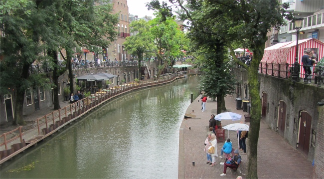
 Oudegracht with Warehouses below Street Level |
We kicked our heels and got talking to a Dutch chap who complained about the weather. I asked him about all the developments going on between the marina and town. He explained that the whole area had been water, and the marina we were berthed in had been elsewhere on this expanse of water, before being relocated to where it is now. That explained why some of our charts had made no sense. Then developers filled the water expanse with dredged sand. Houses were now being built upon the sand, standing on huge 8m long concrete piles driven into the sand. Many of the properties would have mooring space for a boat directly underneath them. Waterways would then be formed between the houses creating a little "Venice". In order for this to work financially, most of the houses would need to be sold as seen on the drawing board. Eventually the bridges we saw sitting in the sand would have water under them, allowing access to the old town. The planned completion date of phase two was 2018; that would be a tough one to meet.
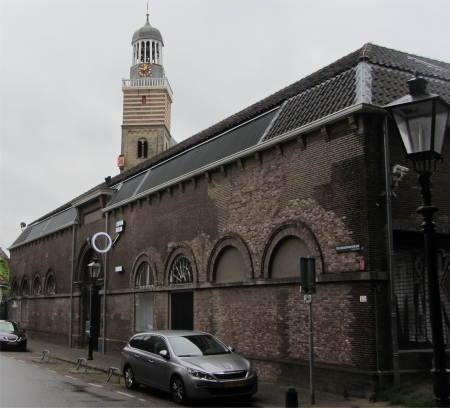
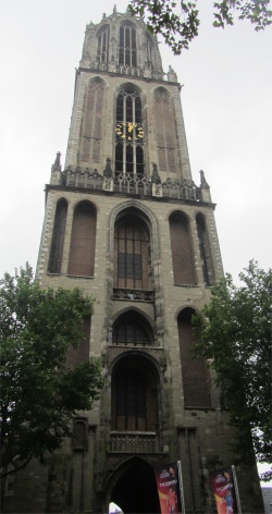 Domtoren |
On alighting the train, we clambered up to the upstairs tier, plonked ourselves down, and started discussing Rex's nightmares about proposals for a large housing estate behind his back garden. A middle-aged fellow in front of us turned around with a beaming smile on his face, and asked, "You're English, aren't you?"
His English was so good I had difficulty establishing whether he was English or Dutch, but guessed from his question he must have been Dutch. "Yes," I replied.
"You are in a quiet carriage, you must remain silent here. Do you see the sign on the window?" he said, pointing to an etched image on the glass.
"Oh, sorry, I did not realise," I apologised. A few stops later he got up to leave the train, wishing us, "Have a nice day."
A large urban sprawl indicated we were passing through the outskirts of Utrecht, and right on time our train halted at Utrecht Central. A kind lady at an information kiosk gave me a map, smiling from ear-to-ear as she explained a route into town and a route to follow around the old town.
Exiting the train station was like walking through Westfield Stratford City Shopping Centre, busy shops everywhere with throngs of folk milling about. We emerged into a large open air market selling every food product you could imagine, plus clothes, books, music etc.
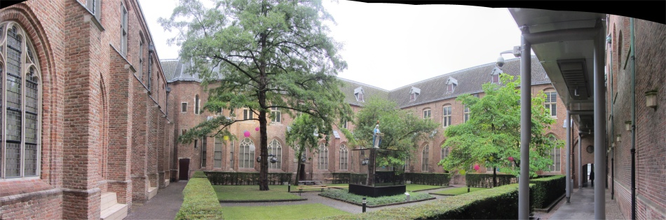
The construction of a Roman fortification (castellum), probably built in around 50 AD, is usually regarded as the founding date of the city. The location on the banks of the river Rhine allowed Utrecht to become an important trade centre in the Northern Netherlands. The growing town Utrecht was granted city rights by Henry V in 1122. When the main flow of the Rhine moved south, the old bed, which still flowed through the heart of the town, became more of a canal. The wharf system was built as an inner city harbour system. On the wharves, 13th century storage facilities (werfkelders) were built, on top of which the main street, including houses was constructed. The wharves and the cellars are accessible from a platform at water level with stairs descending from the street level to form Utrecht's unique structure. Utrecht's ancient city centre features many buildings and structures from the Early Middle Ages.
 Domkerk |
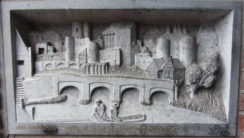 Plaque under Tosteegpoort |
Utrecht, located in the eastern corner of the Randstad conurbation, is the capital and most populous city in the Dutch province of Utrecht. It is the fourth largest city of the Netherlands with a population of 330,000, and its student population of 40,000, the largest in the country, makes the city a very vibrant place. Utrecht is host to Utrecht University, the largest university of the Netherlands, as well as several other institutes for higher education. Due to its central position within the country, it is an important transport hub for both rail and road transport. It has the second highest number of cultural events in the Netherlands, after Amsterdam.
 Centraal Museum |
We headed south along the Oudegracht at street level on its eastern bank, passing the old Stadhuis at a bend in the canal. Below us pleasure boats honked their horns as they weaved their way under a large pedestrianised way situated over the canal at this bend. Grand old one-time warehouses were also sprinkled alongside the canal at street level. It was hard work navigating a way through the hordes of tourists whilst trying to avoid the cyclists at the same time.
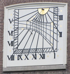 Foundation of Renswoude Sundial |
 St. Catharinakathedraal |
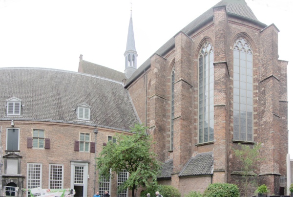
The cathedral was once a lot bigger. In the place of the Domplein was the center nave, and the church was connected to the Dom Tower by a short bridge for the bishop to enter the church without being seen. Apparently, the reason for the gap between the church and tower was to allow easy passage for inhabitants to reach a different church. However, in 1674 Utrecht was hit by a freak tornado and the nave of the cathedral collapsed. The last of the debris wasn't cleared away until 1826. Although the city fathers even considered demolishing the church completely, it was eventually restored several times during the 19th and 20th centuries. What remains of St. Martin's today are the choir, the transept and the Dom Tower. The central nave of the cathedral, which collapsed in the storm of 1674, is now a square with large trees, the Domplein.
 Museum Catherijneconvent |
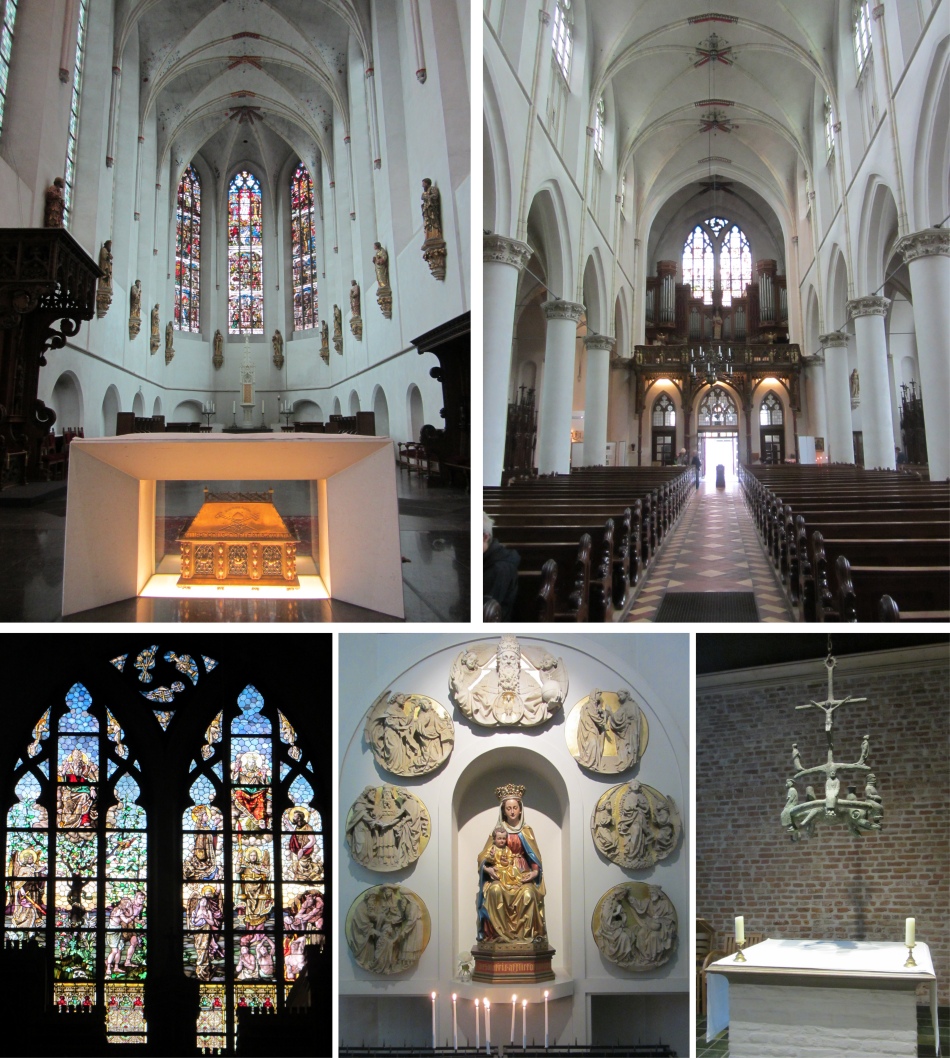 St. Catharinakathedraal Interior |
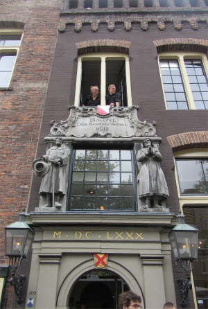
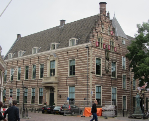 Paushuize |
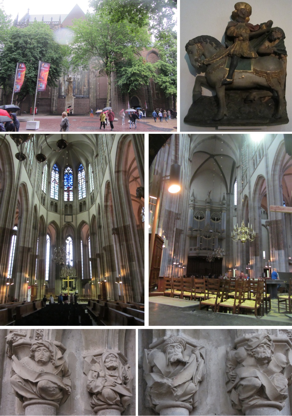
Naturally we ventured inside the cathedral. The light interior of the Domkerk is quite impressive with the many richly decorated and detailed monuments. Yet history has left her traces. During the Reformation heads of sculptures were chopped and many images and altars were permanently damaged. In the years that followed, all the catholic elements, including the stained-glass windows, were removed which changed the character of the church forever.
Having received a shot of culture, we carried on down the Oudegracht, passing a myriad of small shops selling books, music, antiques and all the paraphernalia that tourists buy. Rex was in his element with some of these businesses, particularly the music shops; he completely forgot all about his back. We still needed to keep our wits though, cyclists still continued to appear from all corners of the universe and hurtle past us along the street. Only a few vehicles passed by, and when we spotted a parking meter machine, we stopped to check the tariff: Euros 4.30 per hour, crumbs no wonder everyone was taking to their bikes.
 Janskerk |
In 1754 Maria Duyst van Voorhout passed away. She died rich and childless, and in her testament she determined that her money had to be spent on teaching. A separate foundation was established in three places, namely in Delft, Den Haag and Utrecht. These institutions taught water engineering, shipbuilding and mathematics. The foundation of Renswoude was founded in 1754, with the purpose of giving good adolescents a good education. Today, the foundation of Renswoude is no longer an educational institution, but talented young people up to about thirty years with insufficient financial resources can apply for a grant at the foundation. The foundation building at 5 Agnietenstraat was originally built as an intern for orphans, is one of the highlights of rococo in the Netherlands. Nowadays it is a national monument.
On reaching Nieuwegracht, we followed this "new" canal back towards the centre of the old town. Many bunches of people were on the street, often gathered in huddled groups, peering at leaflets and maps, then heading into buildings. We soon gathered that today Utrecht was hosting an "open garden" event when many gardens secretly hidden behind the scenes could be visited by the public.
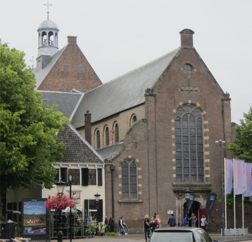
Further along this canal we stumbled across St. Catharinakathedraal. St. Catherine's is a medieval church, although its facade and tower date from 1900. Construction on what was originally a Carmelite convent annex church and brewery started in 1468, on the site of a former guest house and chapel.
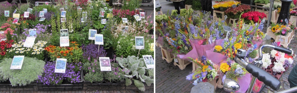 Janskerkhof Flower Market |
 Entrance to Stadskasteel Oudaen |
The exterior remained largely unchanged for several centuries. In 1836, following many years of neglect, part of the northern transept and the roof turret collapsed during a heavy storm. the church was repaired in 1840. Two years later it started to be used as a Catholic parochial church.
Feeling the need for another culture fix, we took a look around this cathedral with its stunning interior and the convent.
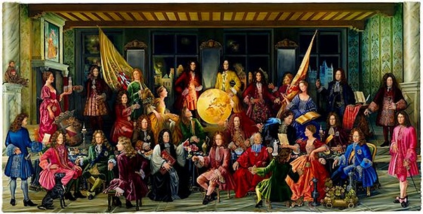 "De Vrede van Utrecht 1713-2013" |
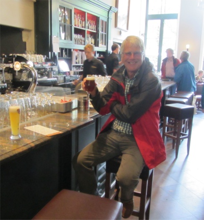 Rex Taking Some Medication in the Stadskasteel Oudaen |
Suitably refreshed we sauntered down Lange Jansstraat and crossed the Oudegracht at the Viebrug, one of the busiest bridges I have ever seen. Armies of tourists crossed it in conjunction with armadas of cyclists. Traffic whizzed down the centre. However, what puzzled Rex and I were cars driving down the edges reserved for cyclists and pedestrians.
We located the Stadskasteel Oudaen with great difficulty (we were looking for a castle, but it wasn't in the conventional sense). Stadskasteel Oudaen is a so-called defensive tower house, built in 1276 during the same period when several others were built along the Oudegracht. The Oudaen castle, probably originally named Zoudenbalch, refers to one of the following owners, Dirck van Houdaen. When the new owner Dirck van Houdaen occupied the castle the Zoudenbalchs family had already moved to a new premise in the Donkerstraat. It is a unique structure, being one of the first stone buildings in Utrecht. Nowdays it is a heritage building and restaurant, and even has its own microbrewery.
How could we pass it by without sampling its wares. We took a seat in The Room of Taste, also named the grand-caf� on the ground floor, which was once was the Hall of Knights of this city castle. One of the walls was adorned with a huge painting, titles "De Vrede van Utrecht 1713-2013" (The Peace of Utrecht) by the Utrecht artist Semiramis Oner Muhurdaroglu. It was only when I closely inspected the painting that I spotted several key characters in the painting were holding glasses of beer. How appropriate I thought.
The beer gave us strength to wander for a while down a few more back streets, where Rex discovered a model train shop where he could relive his childhood. I never had the same problems with my own children when I tried to prise him away from the shop; the tantrums he threw really let the side down. In another shop the poor lad drew a line at buying some of the jackets he liked the look of. At Euros 120 each, I could understand why.
When we'd had enough, we jumped onto a train back to Harderwijk, this time ensuring we sat in the correct compartment. It was crowded with families returning from their day's outing, and exceedingly noisy; a total contrast to this morning.
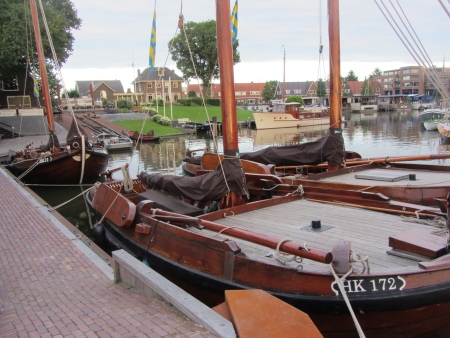 Botters in Harderwijk |
A string of restaurants along the Strandboulevard Oost were quite busy. At one time they would have had a lovely view across a lake, now it was an expanse of sand waiting to be built on. We chose one and dined well. On the next table four men in military attire were eating. They must have been involved in the display provided by a historical military equipment society who had set their equipment up on a green nearby for the last couple of days. Rex came out with the wise crack, "I couldn't tell if they were military or not since I couldn't see their legs because of the camouflage they were wearing." It must have been the beer he had been drinking!
On the marathon hike back to the boat, we walked past a large mobile gun on caterpillar tracks which was parked up on some wasteland. A close inspection was necessary to satisfy our curiosity, and as we did so a man leapt out of a nearby transit van. He was one of the chaps we had seen in the restaurant, and was hanging around for a transporter to turn up to return the large gun to its storage base. He and the other chaps, who had put on the military equipment display, had all served in the military at one time, and were enthusiasts who liked to tour their display of kit around the country. The chap himself had been a sergeant in the army at one time, a most enthusiastic fellow who kindly shared his enthusiasm.