 Dashing Across the Westerschelde from Breskens |
Important priorities first, we checked the water levels under the floors. Between some bulkheads no water had accumulated, but in a couple of others it had. We were not out of the woods yet, but we were homing in on the problematic areas, particularly near the heads. We dried up as much water as we could, and ran the sink in the heads for a while, with no apparent issues, and flushed the toilet several times with no problem. We checked the keel bolts on the starboard side under the main cabin. There was a little water in the vicinity but nothing to write home about. We agreed to leave things as they were for a day or two, and if subsequent checks revealed water still accumulating near the heads bulkhead, then we would need to go under the floorboards and conduct an elaborate process to gain access under the heads.
After a hearty breakfast, we slipped our lines and headed out to the Westerschelde, a highly important route from the North Sea to Antwerp, and worthy of a note or two.
The Westerschelde estuary is located in the province of Zeeland between Walcheren and Zuid-Beveland on the north side and Zeeuws-Vlaanderen on the south side. Unlike the Oosterschelde, the Grevelingen and the Haringvliet, the Westerschelde is not closed off as part of the Delta Works. Instead, the dykes around it have been heightened and reinforced. The reason for this was to keep the port of Antwerp accessible. The Westerschelde is the mouth of the Scheldt. The part from the Belgian-Dutch border to the North Sea is called the Westerschelde and the part from the Belgian-Dutch border via Antwerp to Ghent is called the Zeeschelde. The Westerschelde is a relatively young estuary; the original Scheldeloop and estuary was the Oosterschelde. In the early Middle Ages, on the side of the North Sea, there was only a smaller estuary or inlet, which is listed as Sincfal in historical sources. Further east, near the current Perkpolder, was a peat river called the Honte, which flowed eastward to the Scheldt. In the early 12th century, and possibly as early as the 9th century, storm surges provided a connection between this sea arm and peat river and the Westerschelde was created as a sea arm between the Scheldt and the North Sea. In the centuries that followed, this sea arm has widened and caused numerous floods.
After the fall of Antwerp in 1585, shipping traffic to and from Antwerp was blocked by the Northern Netherlands. This blockade lasted until 1792. In 1809 a British invasion took place in Zeeland, the so-called Walcheren Expedition. The purpose of the British expedition was to capture the French squadron in Vlissingen. In addition, the British were planning to take Antwerp. Since the Belgian Revolt of 1830, access to the port of Antwerp has once again been via foreign territory from a Belgian perspective. In the Treaty of London of 1839, in which the Netherlands recognized Belgian independence, it was therefore laid down in Article IX that the Netherlands should guarantee free passage between the North Sea and the port of Antwerp across the Westerschelde. In October and November 1944, at the end of the Second World War, the Westerschelde was the scene of heavy fighting. The city of Antwerp was liberated by British troops in September 1944 and fell into the hands of the Allies almost undamaged. However, the Westerschelde and with it access to the harbour, were still in the hands of German troops. After the battle, the first allied shipping convoy arrived in Antwerp on 28th November 1944.
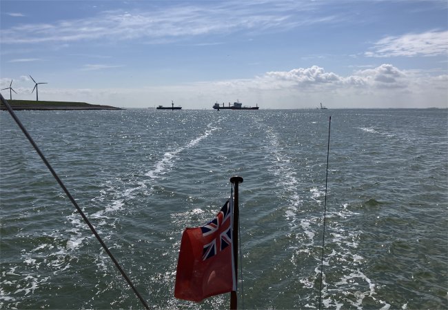
It was only a five-mile journey across the busy Westerschelde to reach the sealock in Vlissingen. But we didn't have it all our own way. A large crane was being towed out of Vlissingen, ferries scurried between Breskens and Vlissingen, five ships and a barge were bearing down on us, plus a pilot boat buzzed us.
It was an exciting crossing, and undeterred we made it to the sealocks at Vlissingen. Once through we passed by large dock basins and Damen's, a huge, ship building company outside of which large, expensive yachts were moored, as well as a naval vessel from the Isle of Man. We navigated our way to the Keersluisbrug, beyond which lay the Kanaal door Welcheren, our route to Middelburg.
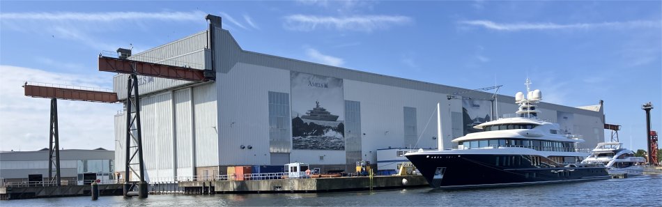 Large Yachts at Vlissingen |
"Sorry, a bridge is broken on the canal, so we have closed the whole section of canal. We hope it will be open by noon," was the response. The operator seemed to be very harassed, probably by the knock-on effects of the problem, and his poor command of English rendered further conversation untenable.
We moved to a waiting pontoon. A small motor boat eventually sauntered up to the bridge, and on seeing the two red lights, stopped a few metres from us. Even though the craft could easily pass under the bridge, the two red lights meant nothing was allowed to pass. I explained the situation to them. After a short conversation we got one of the young Dutch men to board Duonita and use our radio to communicate with the operator in Dutch. He had more success than we had, and reported that the Stationsbrug swing bridge in Middelburg was broken. Best estimates were a repair by 13:30. We thanked the young men, and they disappeared off back from whence they came.
We decided to hang about for a repair to be affected. However, not long into our enforced sojourn, a Tannoy on our waiting pontoon burst into life, and a voice from the ether informed us that the damage to the bridge was serious, and the bridge will be out of action for at last a day; perhaps a few days.
We considered options. Option one was to sail around the North Sea coast to the Roompot entry into the Oosterschelde. That would take 8 hours or more, depending on the tide. Option two would be to travel further up the Westerschelde to the Kanaal door Zuid-Beveland that would provide us with access into the Oosterschelde. This route would be very tide critical and it could take the best part of a day. Option three was to stay put in Vlissingen for the night. Since we had already lost half a day, we opted for the latter.
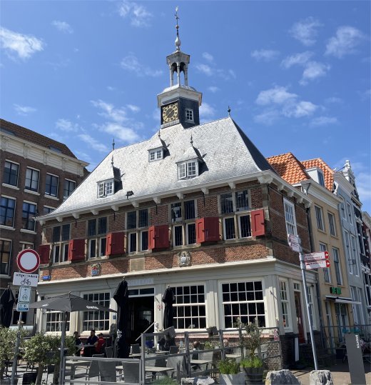
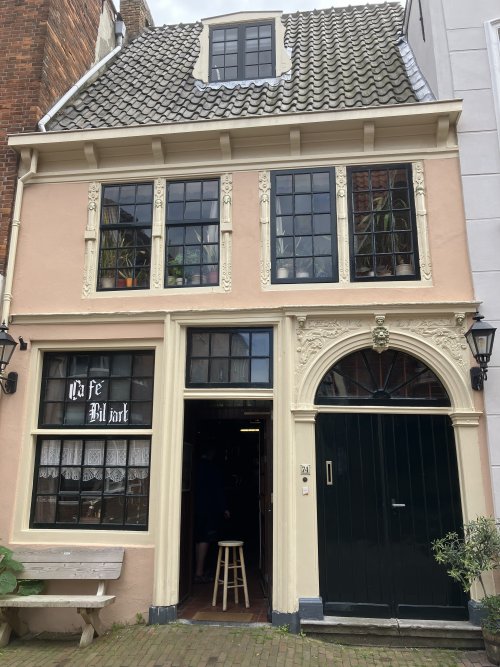 Cafe at Vlissingen |
Off we went to explore the town, trying not to get run over by numerous bikes and much traffic. Our route took us down the Albionkade, where a long, low, river cruiser was berthed. There must have been one big party on board since hundreds of plastic beer crates were being transferred unceremoniously into shore-based refuse containers. Rex and I never had that problem cruising on Duonita.
As we rounded a small basin in Het Dok we stumbled across a floating museum ship, the HNLMS Mercuur. An elderly man on the ship spotted us taking an interest in the vessel. He strolled across to chat with us. He was dressed in old working clothes, liberally coated in oil, so he had obviously been carrying out some repair work on the craft.
He proudly told us about the vessel's history and its modes of operation. The ship was part of the Aggressive class with over 80 wooden minesweepers built in the early 1950s in the United States, and equipped with an AN/SQQ-14 mine hunting sonar to locate moored or bottom naval mines. To do this it had electromagnetic cables to set off mines and other cables to cut through their mooring lines, while they were also equipped with devices which could produce magnetic and acoustical charge to let mines explode. He was quick to point out that nowadays modern techniques use drones and submersibles. The reason for so many minesweepers was that the United States was in need of minesweepers for clearing mines that were laid during the Korean War by various countries. Most of the minesweepers served for many years in United States Navy and other allied navies. One of these allied navies that employed Aggressive class in their navy was the Royal Netherlands Navy (RNN). The Netherlands was loaned six Aggressive-class minesweepers as part the United States' financial and material aid under the Mutual Defense Assistance Program, among these minesweepers was HNLMS Mercuur. The ship arrived in the Netherlands on 22nd July 1954 and was given the pendant M886, and is the only one remaining. It was later used as a submarine support ship till her decommissioning in 1987.
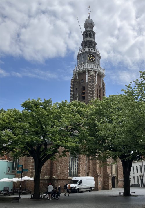 Sint Jacobskerk |
"We don't celebrate the D-Day landings, but in early May we celebrate V.E.-Day, " he replied. He swept his hand around pointing out the mix of old and new buildings in the vicinity. Many old buildings were bombed by the Germans, but many, many more were bombed by the Allies. The man was keen to get us to tour the museum, but we were keen to get on and explore the town. We thanked him for his time and carried on progressing further into the city.
The first reliable records of Old Vlissengen date from a charter of 1247, when the town already had a church and an infirmary. In 1294, the town was purchased by Floris V, Count of Holland, who recognised the strategic and economic potential of its location and began its development. The port facilities were further extended in the mid-15th century, financed by a local monopoly in the herring trade. In the mid-16th century, the town fell into poverty due to the Eighty Years' War, the Dutch revolt against Spanish occupation, and particularly owing to the punitive taxes imposed by the Duke of Alba. In April 1572, the townspeople staged a successful uprising, expelling the Flemish garrison, firing at ships bringing reinforcements and hanging a Spanish nobleman in front of the town hall. Under the Treaty of Nonsuch in 1585, English garrisons were stationed here and at Brill to keep these ports out of Spanish hands. The towns were sold back to the Dutch in 1616.
During the heyday of the Dutch Golden Age, ships from Vlissingen set sail for the various outposts of the Dutch colonial empire and contributed to the world power of The Seven Provinces.
The history of Vlissingen was also marked by invasion, oppression and bombardments. Because of its strategic position at the mouth of the Schelde, the most important passageway to Antwerp, it has attracted the interest, at one time or another, of the British, the French, the Germans and the Spanish. Floods have also been a constant threat. Vlissingen declined during the 18th century. The Napoleonic Wars were particularly disastrous. After 1870, the economy revived after the construction of new docks and the Walcheren canal, the arrival of the railway and the establishment of the shipyard called De Schelde. The Second World War interrupted this growth. The city was rebuilt after the war. In the 1960s, the seaport and industrial area of Vlissingen-Oost developed and flourished. Now this area is the economic driving force behind central Zeeland, generating many thousands of jobs. Nowadays approx. 50,000 ships annually from all corners of the world pass through the Schelde.
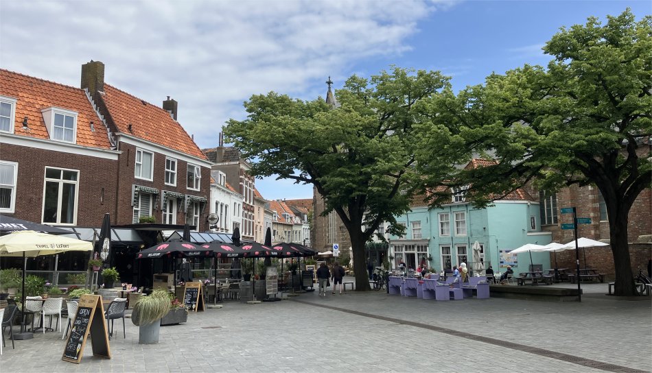 Oude Markt |
The last time we had a look at Vlissingen, we hadn't really discovered the town, but today we pushed through to the busy Oude Markt, passed Sint Jacobskerk Vlissingen, and along the restaurant lined Bellamypark.
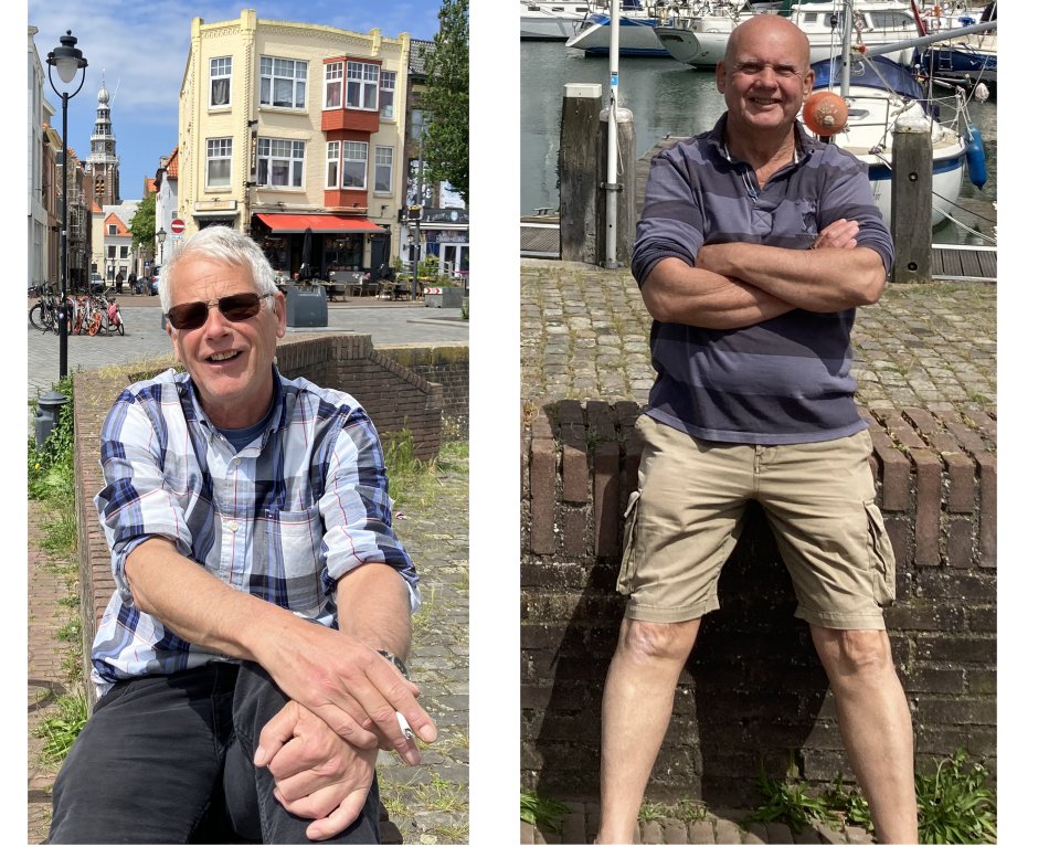 Rex and Me by the Vissershaven |
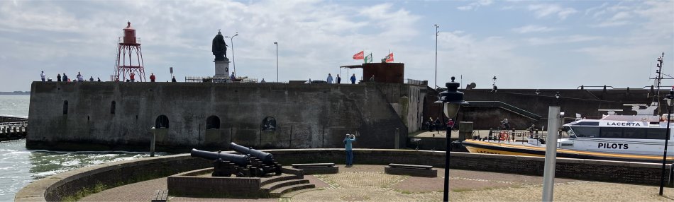 Pilot Basin with Keizersbolwerk Behind, with the Lighthouse for Shipping and Statue of Admiral Michiel de Ruyter Perched on Top |
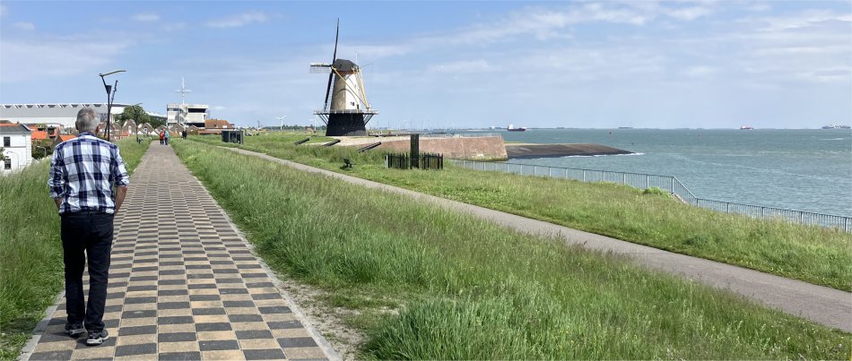 Chequered Shirt on Chequered Path on the Oranjedijk |
"No, it is not used by the port authority, the two white buildings there and there," she said pointing along the seawall, "are both port authority buildings. They control the Dutch and Belgian pilot boats. Shipping heading to and from Antwerp must use Belgian pilots, whereas other ships use Dutch pilots. You will notice the two sets of pilot boats are coloured differently, and they both operate out of the same pilot basin. A pleasure park used to exist by the Vissershaven, and the tower was erected for visitors to the park to climb to an observation deck. It is used no more."
Her English was impeccable. "Where did you learn English?" I asked.
"My family are Dutch. I spent the first ten years of my life near Liverpool, then we moved to South America and ran a hotel. So, I soon learned Spanish. Later, we moved back to Europe, and having lots of French and Germans staying at our hotel, I had to learn French and German too. Nowadays, most young people insist on speaking English because they want to perfect their us of that language. Older generation Germans still insist on speaking German though."
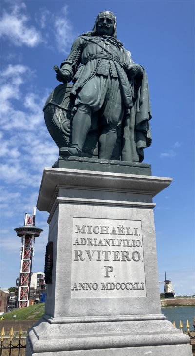 Admiral Michiel de Ruyter |
This Imperial Stronghold was built during the reign of Emperor Charles V, to whom it owes its name. The Low Countries were part of the Spanish empire at the time and in the mid-16th century there was a threat of war between the Spanish on the one hand and the English and French on the other. It was decided to strengthen the Western Scheldt and thus protect it against attacks from the sea. Mary of Hungary, governor on behalf of Emperor Charles, ordered the construction of Fort Rammekens, which was completed in 1547, and also had the port entrance to Vlissingen strengthened. Construction of the Imperial Stronghold was completed in 1548.
During the French period, which lasted in Vlissingen from 1795 to 1814, the Keizersbolwerk was significantly expanded and the current structure was built. By order of Napoleon, thirteen casemates (a casemate is a relatively small concrete or stone bunker, intended to provide cover against enemy fire, and is equipped with embrasures for heavy weapons) were built in the stronghold and the narrow passage from the Roeiershoofd to the Beursplein was created.
The first casemate was used as a waiting room where newcomers had to report. The other casemates were used for storage. Nowadays, some casemates are still used for storage by the Belgian and Dutch Pilotage Services. The garrison bakery was also located in one of the casemates. Two huge brick ovens could each hold 300 loaves of bread. 4,800 loaves of bread could be baked in the bakery per day. The garrison bakery was in use until the end of 1907.
A lighthouse for shipping on the Western Scheldt has stood on top of the Keizersbolwerk since 1891. Perhaps more importantly, the statue of naval hero Michiel de Ruyter has stood there since 1894. The Netherlands' best-known admiral was born in Vlissingen on 24th March 1607. He went to sea as a young boy and would rise from cabin boy to Lieutenant Admiral General, after he had been a mate on a whaler and had worked for the Lampsins mercantile house in Vlissingen.
During the second half of the seventeenth century the Dutch Republic waged wars to protect its trade. These wars were mainly fought at sea. In the period from 1666 to 1673 De Ruyter showed his skills as a Commander-in-Chief. The Four Days' Battle in June 1666, during the Second Anglo-Dutch War, is a striking example of this. Through the intervention of De Ruyter 26 Protestant Hungarian ministers were released after they had been labouring as slaves on the Spanish galleys at Naples for nine months. It would be one of De Ruyter's last heroic deeds. He died in harness on 29th April 1676 when an encounter with the French off Messina proved fatal to him. On 18th March 1677 his remains were interred in the Nieuwe Kerk in Amsterdam.
 Grieks Restaurant Kala on the Beursplein |
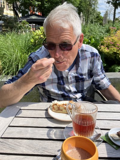 Apple Pie at Bellamypark |
As we headed back to the boat, we passed by the river cruiser on the Albionkade again. An elderly German couple off the cruiser, complete with zimmer-frames, were trying to take a photo of themselves with the ship in the background. I offered my services, and they were delighted. By the tenth shot I had actually got the old chap to give his wife a peck on her cheek. The couple hailed from Cologne, and were continuing on the cruise to Rotterdam, Amsterdam and back to Cologne.
On our return back to the boat, we found other English boats had arrived from Ramsgate, Felixstowe and Southwold. Yes, Holland is a popular destination for British sailors.