"No, never. This boat is designed for inland waterways and calm coastal waters. Sadly, we'll never sail across, but who knows, we may visit some other way. Today, we will visit Veere until noon, then move on. My husband is buying provisions for us now."
"We are heading off to Wemeldinge today, and later down to Yerseke," I replied.
"Oh, you must visit Sint-Annaland", she interjected. "It is a beautiful, small, friendly town with lovely, cozy, little shops and a very good market too. I love to visit Sint-Annaland." She sold it well, and I passed the information on to Rex.
Our other neighbour, an elderly German chap, helped us with our box lines and held our bow steady as we started to reverse out of the box. After thanking him profusely (he enjoyed practicing his English), I shouted, "Tot ziens. Ik wens jullie een goede reijs," to the Dutch couple, and we motored out of the Binnenhaven to the fuel pontoon.
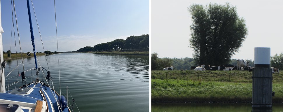 Walcheren Canal |
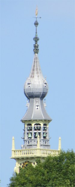 Veere Town Hall Carillon Tower |
All too quickly Veere Town Hall Carillon Tower and the Grote Kerk loomed into view above a swathe of trees. Rex, Meryl and I had visited Veere in 2014; today we would just be passing through.
The small town of Veere stood on the Veerse Meer lagoon. The name literally meant "ferry", perhaps stemming from 1281 when Wolfert Van Borsselen established a ferry there. Veere received city rights in 1355. On 8th January 1488, the "Admiraliteit van Veere" (Admiralty of Veere) was set up as a result of the Ordinance on the Admiralty in an attempt to create a central naval administration in the Burgundian Netherlands. The Vice-Admiralty of Flanders in Dunkirk was subordinated to this. In 1560 under Admiral Philip de Montmorency, Count of Hoorn, this admiralty relocated near Ghent and in 1561 the Habsburg naval forces were also moved to Veere. The city functioned as the staple port for Scotland between 1541 and 1799.
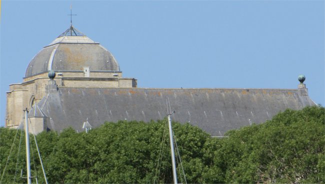 Veere Grote Kerk |
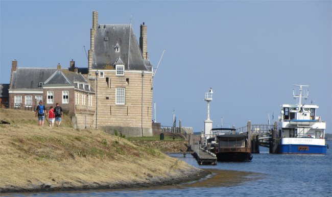 Campveerse Toren |
I had the pleasure of helming Duonita by hand all the way down the Veerse Meer. This was a long meander down idyllic waters with hosts of water craft ploughing their furrows through the sparkling water, many of them German. Holland really is the water play area for Germany. Another herd of cattle could be seen drinking in the water just off the bank; an indication that the Veerse Meer is fresh water.
We glided past the huge holiday complex of Kortgene, famous as the location for emergency dental work carried out on Rex in 2015.
We crept upon the Zandkreeksluis, a huge lock that allowed marine traffic to flow between the Veerse Meer and the Oosterschelde. A few vessels were already moored on the waiting pontoon; we joined them. 20 minutes later a group of boats slipped out of the lock, signalling to the waiting craft to prepare for the sprint into the lock. The abundance of jellyfish in the lock indicated the Oosterschelde was saline. The Oosterschelde is a saltwater lagoon which forms the largest national park in the Netherlands.
Once out on the Oosterschelde, the breeze for some unknown reason vanished, and yachts just lolled lazily on mirrorlike water. The heat was oppressive, 24 degrees.
Behind us the Zeelandbrug, the longest bridge in Holland, gracefully bridged the gulf between the islands of Schouwen-Duiveland and Noord-Beveland in the province of Zeeland.
Our destination was Wemeldinge, a small town just before the start of the Kanaal door Zuid Beveland. Many commercial barges were entering and leaving this canal, which provides a link from the Westerschelde with its access to Antwerp, and the Oosterschelde which gives access to Zuid Holland via the Krammersluizen.
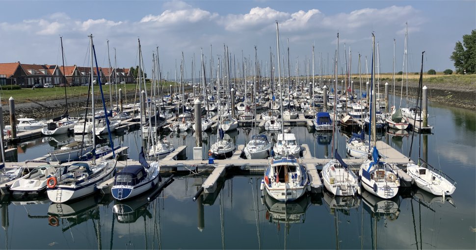 One of Wemeldinge's Two Marinas (Duonita Front Row, Fourth from Right) |
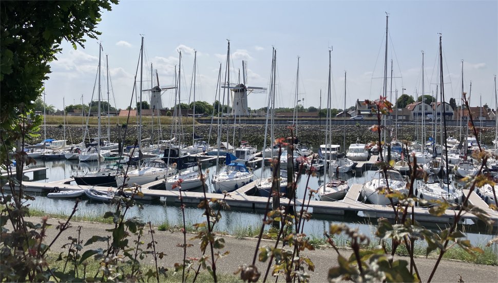 The Other Marina |
I checked us in for two nights, and struggled with the QR code entry code for access to the pontoons but soon had that cracked. After topping up Duonita's water tanks, Rex went below for his "read" while I partook in a hike around town.
The Kanaal door Zuid Beveland actually passed through Wemeldinge at one time, but it needed to be drastically widened. The upgrade took place between 1982 and 1994, and in addition new rail and road bridges were built. The canal entrance was moved a short distance to the east, and the old lock complexes ceased to be used in the early nineties. Wemeldinge has given the locks a new life and they now serve as berths for recreational shipping.
The town was first mentioned in 1222 as Gerardus de Wemelbinghe, and means "settlement of the people of Wimeld (person)". Wemeldinge developed in the 11th century on several small terps (artificial hills), the so-called 'vliedbergen'.
Skirting the yacht basin, my journey took me past two old corn mills: De Hoop and Aeolus. After an argument between the miller and his helper, these mills were built one after the other and near each other. The grist mill, De Hoop, is the oldest of the two, being built in 1866. It was severely damaged during WWII. It was in use until 1968, and was converted into a holiday home in 1969, however was no application for a building permit and the wind mill remained derelict for a long period. It was bought by the municipality and restored between 1981 and 1983. It is frequently in use. Aeolus, on the other hand, can be viewed by appointment only. A small compound containing several fallow deer lay in the shadow of Aeolus.
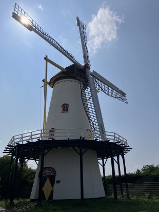 De Hoop |
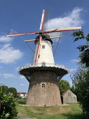 Aeolus |
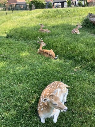 Fallow Deer |
I ended up crossing the Binnendijk and climbing a flight of steps up to the Promenade where an excellent view was afforded across the Oosterschelde with the Zeelandbrug and the Sint-Lievensmonstertoren in Zierikzee visible in the distance. A wide expanse of beach stretched below.
Evening was spent having a few beers and food at Smits. An eclectic mix of people came and went. One woman complained about her food, and I think she was told to get on with it. Another woman complained her meat was not done enough, and that was sent back, probably for a couple of minutes in a microwave. But we enjoyed our food and leisurely stroll back to Duonita.