 HSWV Marina |
Strong winds whistled through rigging through the night, raising concerns as to whether the journey would proceed or not.
I always find it impossible to sleep properly if I need to get up early, usually fitfully sleeping, waking up every 10 minutes or so to check the time, despite having a plethora of alarms to wake me on time. As a consequence, I hardly slept at all, and gave up the ghost at 02:30, got dressed and put the kettle on.
Rex's alarms all sounded off at 3am, and I had a mug of tea waiting for him. He always needs a minimum of a tea followed by a coffee to get kick-started in the morning. We prepared all the ropes for casting off, and called up the harbour master, who pointed out that our VHF transmitter was working intermittently. He gave us permission to leave. And so, in a chilly, windy, early morning, we cast off and left Den Helder just as we had arrived, in the dark small hours of the morning.
 Midlumerlaan Bridge |
Rex and I took turns at steering our vessel along the twisting well-buoyed route, first skirting the lower coast of Texel before winding our way east to pick up the eastern extremity of the Afsluitdijk that separated the Ijsselmeer from the Waddenzee. The Afsluitdijk provides a road link between the provinces of Friesland and North Holland. About 4km from the coast of Friesland, Kornwerderzand stood on a former artificial island which was created during the construction of the dam. The settlement has a population of just over 20. It is part of the municipality of Wonseradeel. The shipping locks at Kornwerderzand, also known as the Lorentzsluizen (Lorentz Locks), provide access to the Waddenzee from the Ijsselmeer, and a complex of discharge sluices control the water level in the Ijsselmeer. A second complex of sluices and locks is located at the other side of the Afsluitdijk, near Den Oever. I cast my mind back to two years earlier, when Rex and I had passed through the Lorentzsluizen on our way to the Baltic with Alan.
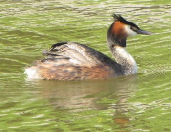 Grebe in the Marina |
Not long afterwards, an armada of fast, larger yachts were hounding us, all having just been released by the Lorentzsluizen. Several of them overtook us, and were later seen heading off up a deep channel towards Terschelling.
By 09:30, we were heading into Harlingen, where we swung a left inside the harbour entrance up to the Tsjerk Hiddessluizen, one of the locks that connected the Friesland canals to the Waddenzee. The lock derived their name from Tjerk Hiddesz de Vries, an admiral who was killed in 1666 during a sea battle against England. After a little gilling about, the gate opened and we entered a very large lock with two other small craft. To our surprise, instead of us rising in the lock, we actually fell, indicating that the inland waterways in Friesland are about level with mid-tide at sea-level. When I think about it, if a lot of the country is below sea-level, then the drop should be obvious.
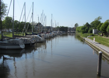
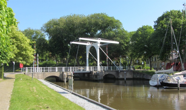
Once out of the lock, an immediate turn right, avoiding the small German motor boat meandering out of the offshoot at crab pace, brought us to the HSWV marina in the Noordergracht. We slowly edged our way in. There was nowhere to pull up at the harbour master's office, and as three pairs of eyes scanned a long line of boats berthed in boxes for a space, a voice called out. It was the harbour master, who had spotted us and sprinted along a pontoon to catch up with us. After a brief exchange we were allocated a box in which to moor Duonita. This was a delightful little section of canal, quiet, lined with trees and some tasteful houses. At the eastern end of the marina, the pretty Midlumerlaan Bridge stood where centuries ago one of the town gates marked an entry point into the fortified town. A few berths existed on the other side of the bridge.
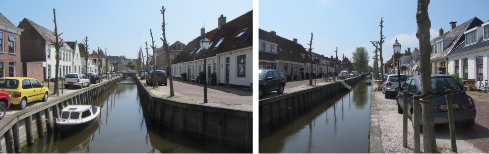 Zuitsloot with its Pollarded Trees |
It gave us time to reflect on this region of the Netherlands that we wanted to explore. From north-east to south-west Friesland there are many small and large lakes, which are connected to each other by way of canals, waterways and rivers. The total water area is more than 11,000 ha and it is all on the same level. So you can sail without going through locks or sluices. Friesland is not just a land of lakes and water and extensive meadows. In Gaasterland between Mirnserklif and Wijckel there is an large forest area with footpaths and openings onto meadows and fields. Traditional farms pepper the landscape, with their shiny black or terracotta red roof tiles, and fields often contain characteristic Frisian pedigree cattle or the elegant black Frisian horses. All of this, plus the most historic villages and towns, rendered Friesland a must visit region.
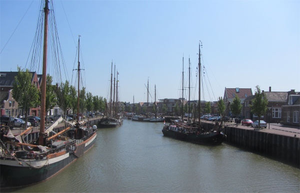 Zuidehaven with its "Brown Fleet", and Barge Heading for a Crunch |
But chilling out sipping tea, watching the world go by and pondering on Friesland couldn't last forever. We needed fresh provisions, so we took a stroll through town along streets full of well-maintained houses that fronted straight on the roads. We picked up a canal, the Zuitsloot, guarded by pollarded trees, and followed it to Noorderhaven. This large basin was also a marina, approximately double the cost of our HWSV marina, lacking the beautiful trees, and had noisy roads running alongside it. We agreed we had the better deal.
At the end of the canal, we bore left and walked down the Zuiderhaven, a haven for sailing barges, many of them being excursion ships of "the Brown Fleet" (authentic ships with brown sails). We casually watched one gracefully gliding up towards the pilings by the harbour side to disgorge a deck full of noisy schoolgirls. The barge drifted towards the solid pilings and effortlessly collided with them in a sickening crunch and splinter of timber. Oh dear!
One of the town's two supermarkets stood by the haven, and once loaded with provisions for an evening meal, we headed back by the main drag, stopping for a coffee at a street cafe on the way.
The very early start to the day had taken its toll of us, and after an early evening meal, we all retired for some well-earned sleep.