
A quick breakfast and we were off heading up Het Nieuwe Diep. The quickness dropped off when we turned right at the end of the Diep to face the lock into the Noordhollandsch Kanaal. A barge and work boat were already there waiting for the lock to open. We tied up to a pontoon, and waited and waited. I heard a conversation over the airwaves. I think it was the barge owner giving a strong verbal complaint to the lock-keeper. That did the trick, and within five minutes the barge, work boat and us were all squeezed into the lock. After another eternal wait, we were released; the barge bulldozing its way out before the rest of us could contemplate moving.
At last we were moving along the Noordhollandsch Kanaal (North Holland Canal). We had travelled along this canal before in 2015.
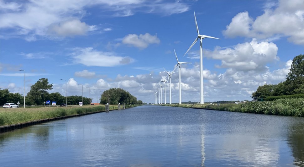 |
 The Beautiful Noordhollandsch Kanaal |
 Intricate Roofs |
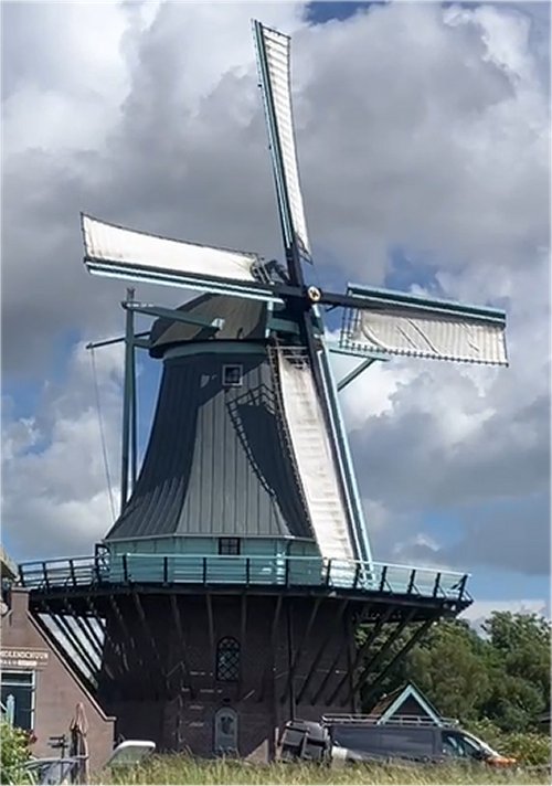 Working Windmill |
The Noordhollandsch Kanaal is a historic 80 km waterway, the longest canal in the Netherlands, connecting Amsterdam to the naval port of Den Helder. Commissioned by King William I, it initially allowed deep-draft seagoing vessels to bypass the silting-up Zuiderzee. The canal was created by connecting a number of existing waters (including the ring canals of the Beemster and the Schermer), which of course had to be widened and deepened.
Construction began in 1819 and 5 years later, on 15 December 1824, the royal frigate Bellona sailed from Amsterdam to the Nieuwe Diep in Den Helder for the official opening. In the opposite direction, the Batavian merchant Christina Bernardina sails into the canal. A warship and an East Indiaman can pass each other without any problems, because the North Holland Canal will have an unprecedented width of 37 metres and a depth of 7 metres. It was the widest and deepest canal in the world at the time.
 Raft Bridge |
Most of the bridges are bascule bridges which rise to salute us as we pass underneath them. A few are swing bridges and some are raft bridges that float, but separate in the centre and roll back into a recess in the banks. Both sides of the bridge have a pair of lights to inform mariners. A single or double red means no entry. Red and green means get ready, anything can happen in the next half hour, and green means go for it through the open bridge.
The issue is getting the bridge keeper to open the bridge for you. We learned over the course of the next few hours that a special phone call is required to open a rail bridge. Trains run to a time table, and during busy periods they stay closed for a long time before a suitable gap appears in the time table to allow bridge opening; trains have top priority. The bridge keeper will give an exact opening time, and mariners just have to sit and wait it out.
Road bridges are a different kettle of fish. We discovered a phone number that sometimes worked. Bridge keepers on this canal often communicated via VHF 20, though randomly it would be VHF 18. Some bridge keepers didn't respond to calls, and sometimes we'd get an estimate of when it would be open. In the latter case we'd gill about waiting for the road barriers to go down thus halting traffic. Then hopefully, lights would change to red/green and the bridge would eventually open. Even then, we were supposed to gill about until the lights turned green. Years ago we went through on a red/green light and received a strong reprimand.
This exercise is a real chore. Occasionally a bridge keeper would anticipate our passage and open the bridge on his own initiative, but this was far from being the norm. Rex was slowly being transformed into a blithering idiot by this time-consuming palaver.
As we reached the outskirts of Alkmaar, we tied up to a large barge pile so that we could hang off it whilst waiting for yet another rail bridge to open. The wind was still strong, and gusting about from all directions. There was a danger the stern of Duonita might hit another pile, so Rex shortened the bow line. I heard a loud thump from the bow, and mentioned it to Rex when he was free. "I hope it hasn't damaged anything up there," he shouted. I went for a check; the navigation lights had been completely demolished and bits were probably at the bottom of the canal.
I called up the harbour master for the Luttik Oudorp marina, which we have visited in the past. He was a very helpful chap, explaining that we could stay in the marina by the Turfmarkt. That was quickly ruled out when we learned it was for motor boats only.
"That is no problem," said the harbour master, " I will find room for you in Luttik Oudorp. Where are you now?"
"We're waiting for the Spoorbrug to open, that's the rail bridge," I replied.
"That's not an issue for me. Call me back when you are near Luttik Oudorp, and I will open the bridge at the entrance for you," he replied.
I thanked the fellow for his understanding. We passed the Spoorbrug, Victoriebrug, Tesselsebrug, Ringersbrug and reached the Friesebrug. The bridge keeper advised that due to the heavy traffic, the bridge would not open until after 6pm. Great, about 1.5 hours wait. There was nowhere sensible to tie up.
I thought the harbour master would not wish to hang around for us, so I called him up and explained the situation. He kindly suggested we turn around and go back towards the police station where a string of boxes lined a short cul-de-sac off the canal. I thanked the man profusely, and we headed back to Afgesneden Kanaalvlak by Mallegatsplein, and found a free box. I booked us in via an App, and booked the electrical connection; job done.
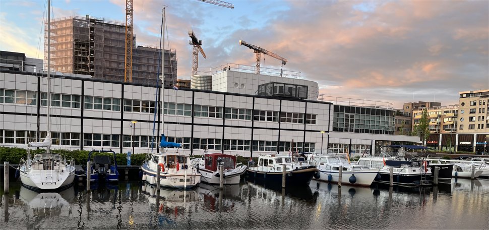 Duonita in a Box in Afgesneden Kanaalvlak by Mallegatsplein |
We had time now to catch our breath and contemplate Alkmaar. The earliest known reference to the town was recorded in the 900's. The little village grew and became wealthier through trade and agriculture, and in 1254 it was eventually granted a charter to become a city. The oldest part of Alkmaar lies on an ancient sand bank that afforded some protection from inundation during medieval times, though the city was always in a slightly precarious place, being only a few feet above the sea, protected from the sea by a line of sand dunes. It was also considered to be a very important place from a defensive point of view against the West Frisians whose lands were close by.
The city continued to trade and prosper over the centuries. In the early to mid-1500s a lake near to the city was the first lake to ever be reclaimed by having its water pumped dry by windmills. In 1573, in the Dutch rebellion against the rule of Spain, town after town fell to the Spaniards, until they reached Alkmaar. Alkmaar was put under siege by the Spanish. The inhabitants and the rebels, staunch supporters of the Protestant cause, repulsed each Spanish assault. The Spaniards were not invincible after all! "Victory begins at Alkmaar" became a byword. This victory was considered an important battle in the eventual breaking free from the rule of Spain.
During these times Alkmaar grew into a very important market for all of the produce of the surrounding areas and became the biggest city in the north of the Netherlands. And the market that still runs in the city is a remnant of this. It was during the 1600's that the street map of the old town was brought into being, although much of the city's building were lost in the renovations of the 19th and 20th century. At the turn of the 19th century the city was briefly held by a combination of Russian and English forces, although they were eventually beaten in battle.
In the early 1800's the city was given a boost to its trade when the North Holland Canal was dug, and in the later part of the century the city was opened up to even more trade, by the arrival of the railways from Haarlem and Den Helder. In the 20th century Alkmaar expanded into the city and municipality that it is now. With the expansion of both residential and industrial areas, Alkmaar absorbed the nearby towns and villages to reach the size that it is today.
We used a footbridge to cross the Afgesneden Kanaalvlak, and strolled down Paternosterstraat to Canadaplein, which received its name in 1945 by way of gratitude for the share of the Canadians in the Dutch liberation.
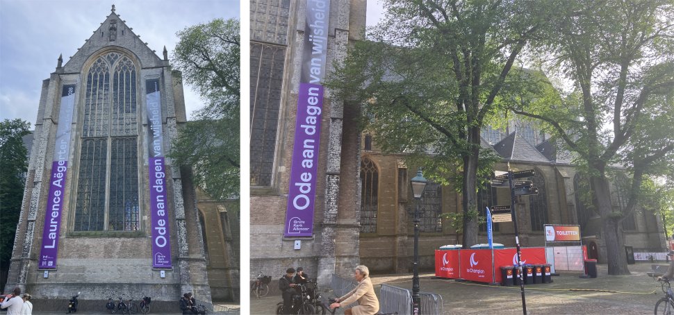 Grote of Sint-Laurenskerk |
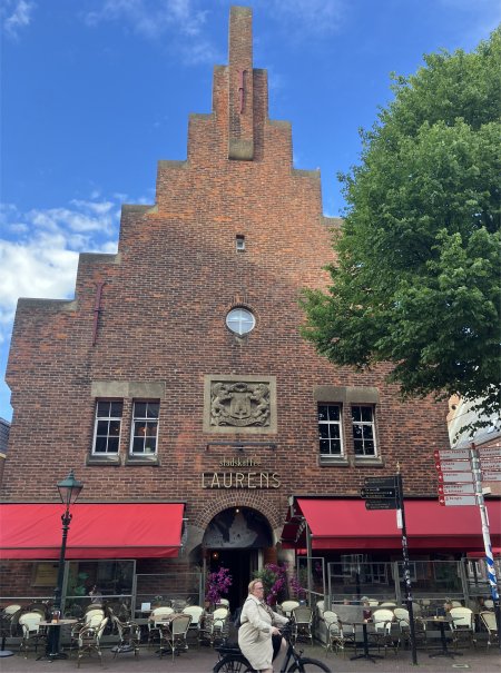 Laurens Coffee House |
Dominating the square was the Grote of Sint-Laurenskerk, built upon an embankment of an old sand hill. About the year 900 the first people of Alkmaar established a wooden chapel here, surrounded by lakes and water. The oldest remains date back to the 11th century when it housed a Roman peat stone hall church. In the second half of the 15th century they were working on a tower which collapsed with great force in 1468, killing two nuns. The construction of the present-day church started in 1470 and was completed in 1520.
Heading east from the church, we passed the Laurens coffee house and shortly afterwards the Hooge Huys, a former office building of the insurance company 't Hooge Huys, now VIVAT. The complex to which Hooge Huys belongs was designated as a national monument on 25 January 2002 and on 10 May 2002 it was actually registered in the national monument register. In addition to the Hooge Huys, the Princenhof and the concierge house from 1933 and the Hof van Teylingen from 1961 also belong to the complex. The Princenhof, with concierge house, is also classified as a national monument. At the end of 2013, the Hendrik de Keyser Association took over the building. Hendrick de Keyser Monumenten is a Dutch association dedicated to the preservation of architecturally and historically valuable houses. The association is named after the Amsterdam master builder Hendrick de Keyser.
 Hooge Huys |
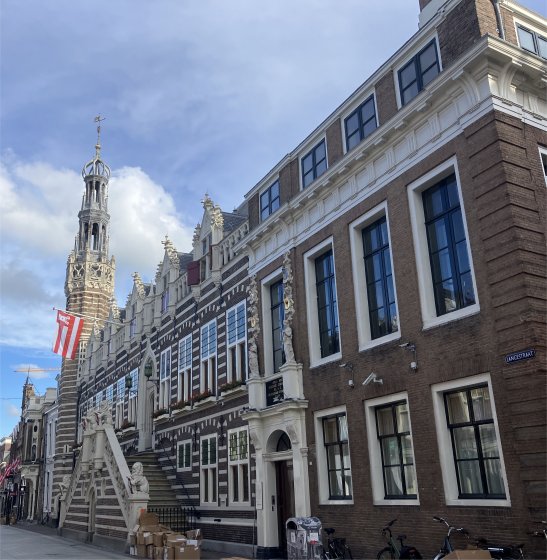 Stadhuis |
Further down Langestraat, we came to the Stadhuis. Around 1500, with no means for improving the building, a number of church wardens proposed to provide financial assistance. Above the entrance, an inscription states that the work began in 1509. It was ready around 1520, and in 1694, after many renovations, it was decided to expand the Stadhuis. A large part of the building was destroyed by fire in 1890, resulting in the Stadhuis being renovated in 1912-1914, the start of a long series of renovations. Two statues at the entrance represent "Truth" and "Justice". Nowadays, some officials still work in the building, and weekly, bridal couples are seen climbing the stairs. Sadly it is not open to the general public.
 Moriaanshoofd |
Just past the Stadhuis is the Moriaanshoofd, originally a large patrician mansion. It gets its name from a tavern that once stood here. Napoleon's brother stayed here on multiple occasions. In 1718, the Mariaanshoofd was purchased by Simon Schagen, one of the aldermen of the city. In the following year he had the house dramatically modernised. As with many houses of those days, he had the gable represent his profession, in his case a symbolic representation of "the good judge". The statues regard the virtues of the principal; such as wisdom, carefulness and vigilance. In reality Simon was not such an honest brother and his private life progressed none too smoothly. After the death of his first wife, he married a second time to a rich widow. She appeared to be a jealous and suspicious woman. The story goes that the bay window was rebuilt at her request so that she could watch her husband when he went out for a walk in Langestraat. She was so suspicious that she did not move her assets to Simon's house after their marriage, and so one night he stole her debentures. The case ended up in court, and this certainly didn't do any favours for the reputation of the man who had decorated his house with his good features.
We continued down Langestraat past numerous shops and cafes, eventually coming to the Mient at the end by a stretch of canal. A paved area stretched across the canal here, on the other side of which a group of colourful facades of historic buildings proudly stood in the sunlight.
 Colourful Facades on the Mient |
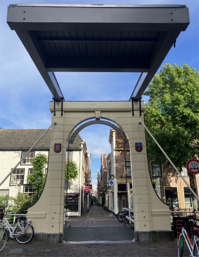 Bathbrug |
Turning to our left we ambled up the Mient, past the Bathbrug, and into the Waagplein. Here we took the opportunity to eyeball the Waag which dominated the square, and dated back to approximately 1390. It started life as a Holy Spirit House, that is a guesthouse for the reception of poor travellers and sick people. In 1582, after the re-acquisition of the weighing right, it was rebuilt into the Waag (Weighing House). It took two centuries for the square to expand to its current size.
The Gothic windows indicate the building's previous ecclesiastical connection. On the front gable at the waterside, the maxim "S.P.Q.A. Restituit Virtus Ablatae Jura Bilancis", (Courage and strength again bestowed the weighing right on the administration and citizenry of Alkmaar), can be seen. This is really a reminder of the successful defence of the people of Alkmaar against the Spaniards in 1573, for which they acquired the weighing right by way of gratitude. In 1712 multiple maxims, such as "Vive memor leti, fugit hora" (Live remembering death, time passes quickly) and "Singulas horas Singulas vitas puta" (Consider each hour a separate life), were placed under the clock face. Sadly it was closed today, naturally.
 Waag |
 An Enjoyable Beer in Waagplein |
In the 15th century, a monastery was built north of the city of Alkmaar. This "Sint Maria Magdalena" monastery is now located in the middle of the city of Alkmaar due to urban expansion.
In 1574, the building, also known as "Het Witte Hof" due to the attire of the nuns, was purchased by Diederick van Sonoy. During the Eighty Years' War against the Spaniards, he was an important lieutenant of William of Orange and also governor of the Northern Quarter. Thanks to him, the Spaniards were driven out of Alkmaar on October 8, 1573. Due to the dikes being cut, the Spaniards were forced to lift the siege.
At the end of the 16th century, the complex passed into the hands of Mr. Willem Bardes. He had the former monastery converted into a luxurious residence. He also expanded the building with the striking octagonal lookout tower. Purely as a status symbol.
In the 18th century, the building was turned into a "diaconie Oude Mannen en Vrouwen huis" (a home for elderly men and women). Then, in 1978, the building was divided and received its current layout with various shops, residences, and, of course, Restaurant De Heeren van Sonoy. The entire complex is also known as Hof van Sonoy.
The food was very good.
 De Heeren van Sonoy |