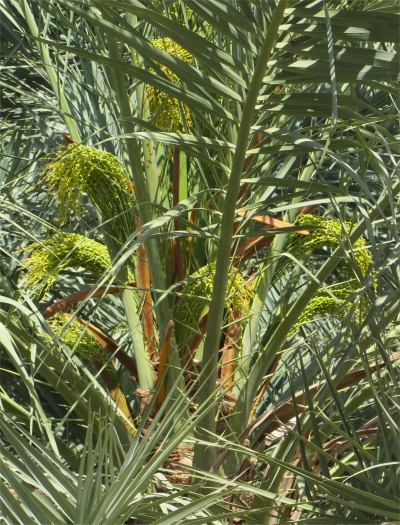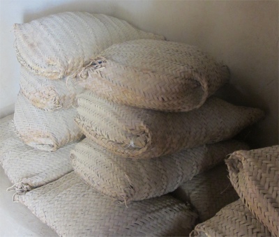
Date Sacks made from Palm Leaves
|
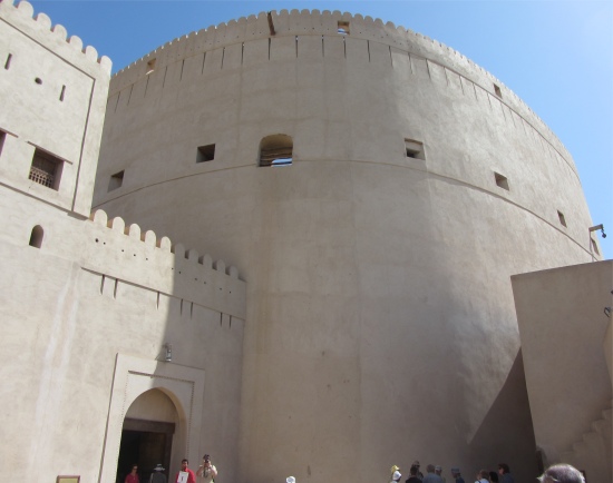
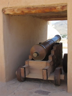
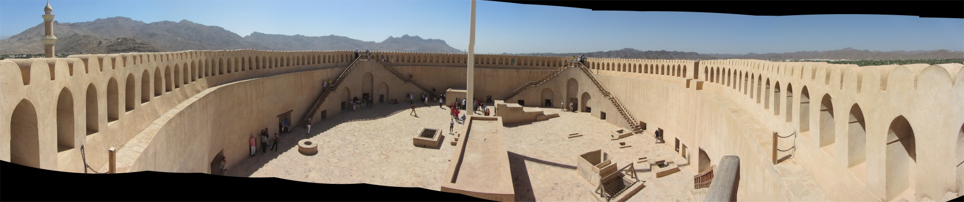
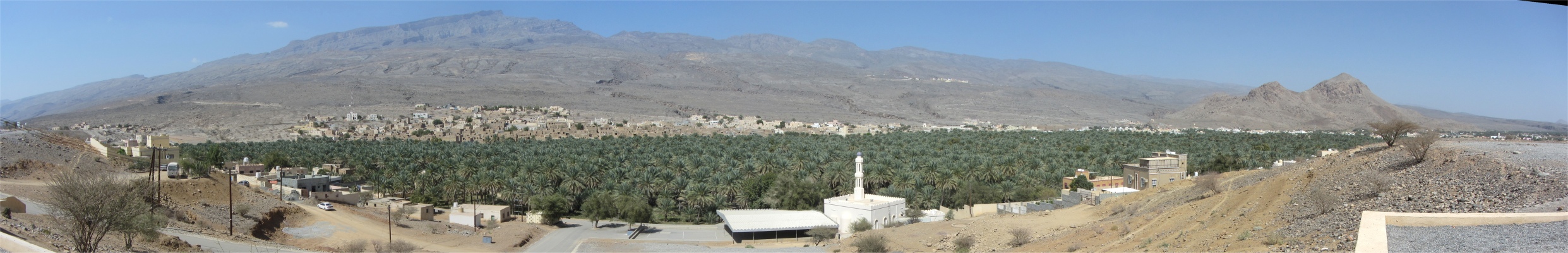
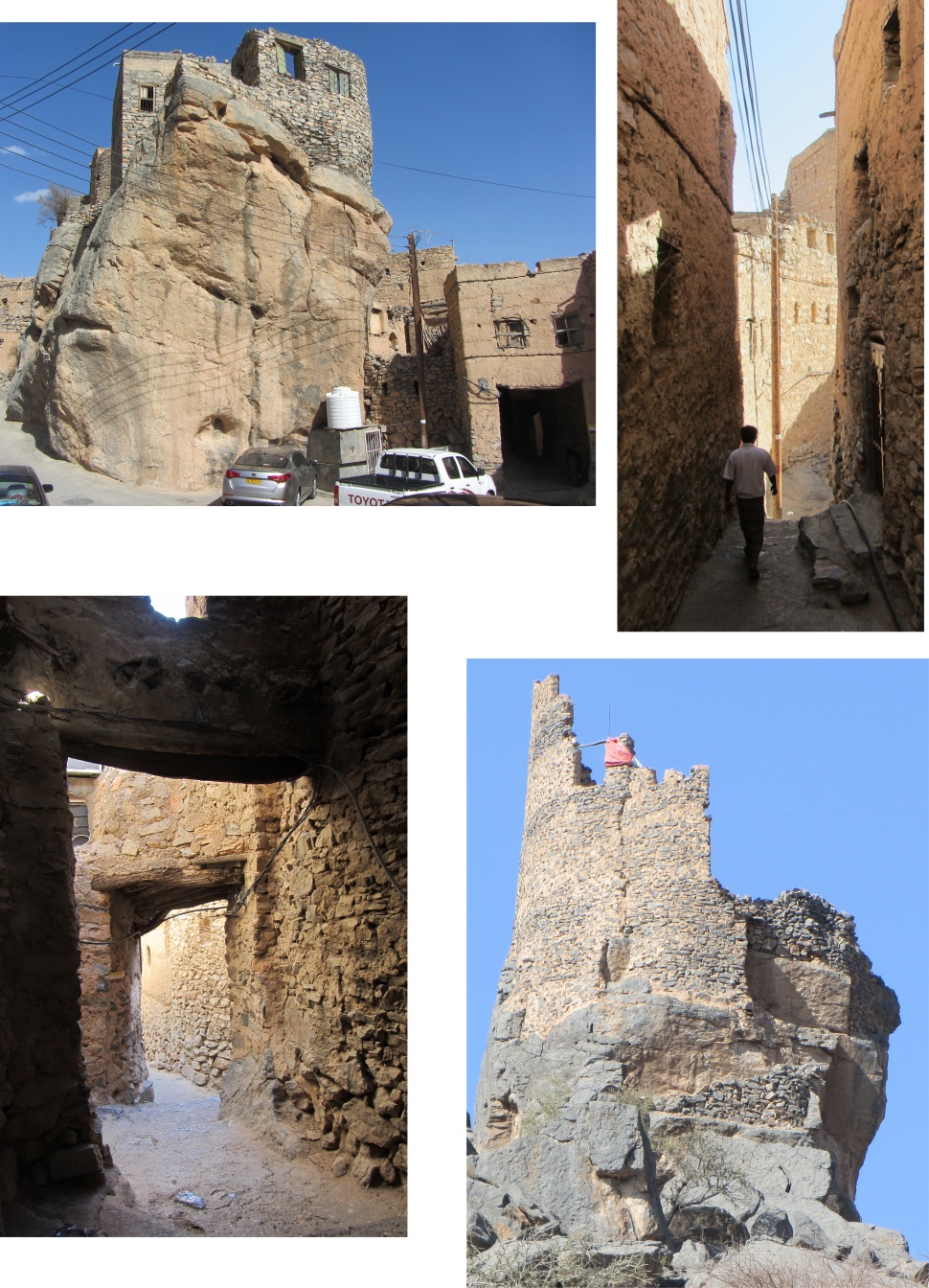
A horizontal platform at the top of the staircase provided a 360 degrees sightline above the rooftops of Nizwa to shimmering date palm plantations and vast and silent wastes beyond, defended by 23 encircling cannons. Curtain walls rose 10m above the platform, providing a circular walk for musketeers who were able to fire from behind the protective safety of the crenulations.
Abdullah left me to explore the fort at my own pace. The lowest level of the fort contained a museum containing both artefacts and display boards relating the history of the fort and its environs. At the horizontal platform, where the narrow openings to the "murder holes" could be seen, three sets of staircases up the curtain walls provided access to superb viewing points across the old city, new city and the souq.
Large quantities of dates were stored inside the fort as a defensive measure in case of a long siege. There were two date stores, the smaller of the two could accommodate 2.5 metric tons of dates at one any time. For long-term storage, dates were packed in palm-sacks using an iron or wooden truncheon to eliminate air spaces. A single date sack could weigh as much as 70kg.
Date sacks were stacked in rows, one on top of another. Pressed under their own immense weight, the dates oozed thick, honey-like juice, which was channelled into jars on the floor. In peacetime this juice found everyday use in the fort kitchens, but when danger threatened it was heated in large copper boilers and made ready to pour onto attackers through the "murder holes".
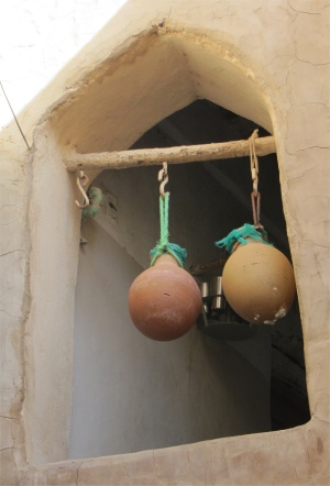
Dates for everyday use were stored in a large, earthenware jar. Such jars had narrow necks to minimise exposure of the contents to sunlight, dust and pests.
Nizwa Souq Pulses
|
Musket Stall
|
Silver Khanjars
|
Mandoos - Wedding Dowry Chest
|
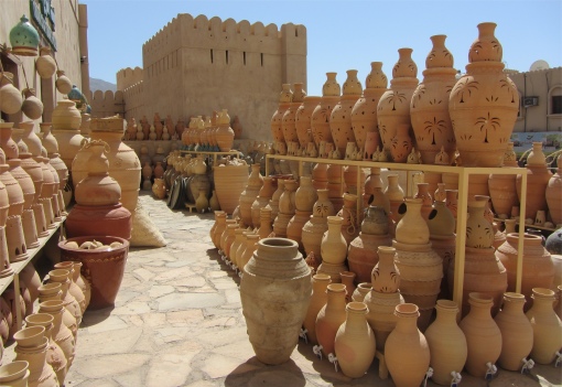
Nizwa Souq Pots
|
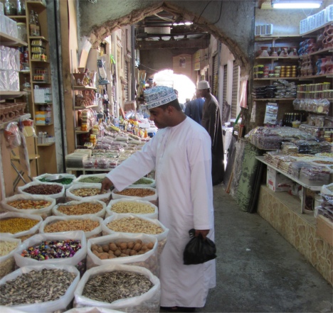
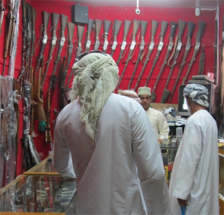
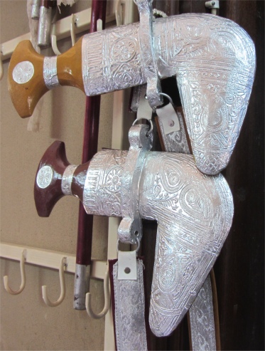
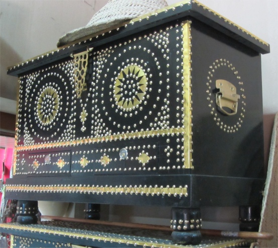
On my return to ground level, Abdullah took me on a guided tour around the old East Souq and the New Souq where men stood by their stalls selling woodwork and jewellery, rugs and ceramics, and chatted on their mobile phones. The walled souq of Nizwa is one of the most important markets in Oman, and encompasses an area of around 7,500 sq. m.. Partially restored in the 1990s, it was zoned into different sections for the sale of specific commodities, such as fruit and vegetables, fish, dates, crafts and DIY goods. Bordering the main selling areas were rows of temporary vendor stalls, artisan workshops and a large, palm-shaded ring for the parading of livestock.
Nizwa Souq was much more than a trading place. It was a living social phenomenon, reaching far beyond the local community to promote interchange between distant villages, mountain settlements, and the Bedouin tribes of the desert territories. Within its protective walls artisanary and industry flourished, alliances were formed and the latest news was exchanged through the ebb and flow of daily commerce. Here, life moved in time with the past. These people still valued leisure, courtesy and conversation.
We extracted ourselves out of the souq, the air outside at this altitude being a cool 28 degrees, but it seemed much warmer for some reason. As we headed out of town I noticed on a flat stretch of ground on the outskirts of the city, patterns of rocks deliberately laid out on an otherwise cleared surface. Abdullah explained that these marked tombs. A single rock defined a female tomb, and a pair of rocks marked out a male tomb.
Wadi Ghul at Ghul with Ancient Ghul behind, and More Ruins on Ridge Summit
|
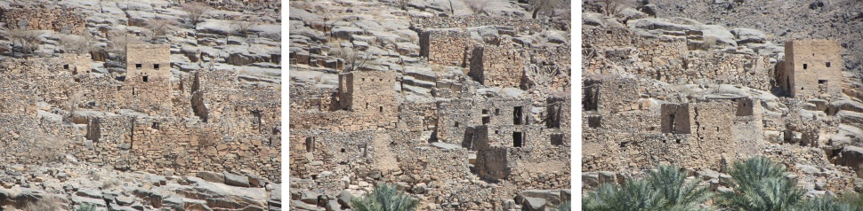
Ancient Ghul
|
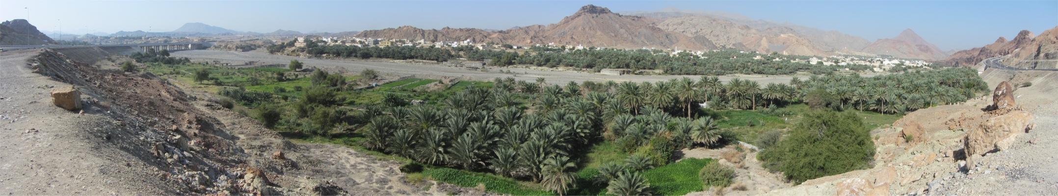
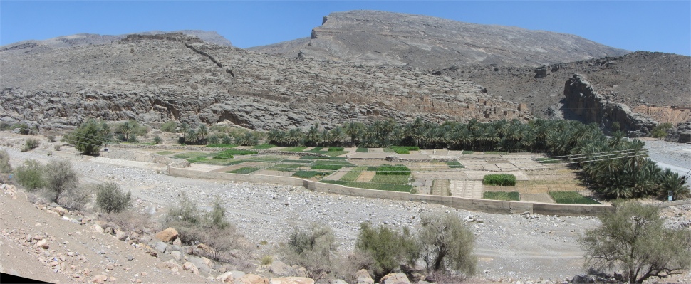
A few kilometres out of the city we pulled of the road to take a look at the village of Ghul, located at the junction of Wadi Ghul and Wadi Nakhal in the southern flank of the Oman Mountains to the west of Nizwa. Wadi Nakhal follows the foot of the mountains and was in the past the main connection to Dhahirah via a pass known as "Akabat al Barak". Wadi Ghul cuts deep into the southern flank of the Oman Mountains near Jebel Shams, its highest point, and this spectacular gorge is known as Arabia's Grand Canyon.
In the wadi before me, a verdant swathe of cultivated land lay. A patchwork of small fields played host to growing rice and corn, surrounded by date palms. On the eastern side of the mouth of the wadi, high and dry on an alluvial gravel terrace stood the modern settlement. On the other side of the wadi, the old abandoned village perched against the cliffs, just above the palm grooves and fields flanking Wadi Ghul. This thousand-year old settlement, being built out of local available limestone, was almost perfectly camouflaged. A large wall snaked from the ruins up the spur to another set of camouflaged ruins that nestled on the summit, effectively creating a defensive triangle between the wall and Wadi Ghul in front and Wadi Nakhal at the back. There hung an ancient and decaying scent of old civilisation.
Abdullah told me how the old village was regarded by locals as being possessed by spirits, and they refused to enter it. Story had it that outsiders who once entered it came out insane. I didn't chance it, I'm mad enough. Having a long gaze at the crumbling ruins, with their colours dry and burnt like the colours in pottery, and the sun-baked sand surrounding me, a poem I knew sprang to mind, which seemed quite appropriate to the sight in front of me:-
Ozymandias
I met a traveller from an antique land
Who said: `Two vast and trunkless legs of stone
Stand in the desert. Near them, on the sand,
Half sunk, a shattered visage lies, whose frown,
And wrinkled lip, and sneer of cold command,
Tell that its sculptor well those passions read
Which yet survive, stamped on these lifeless things,
The hand that mocked them and the heart that fed.
And on the pedestal these words appear --
"My name is Ozymandias, king of kings:
Look on my works, ye Mighty, and despair!"
Nothing beside remains. Round the decay
Of that colossal wreck, boundless and bare
The lone and level sands stretch far away.'
Percy Bysshe Shelley
Leaving the spirits in peace, we now started climbing in earnest up to Jebel Shams. As we zigzagged up one range of craggy mountains, we were confronted by other sets behind them. At this altitude, great, yawning expanses of absolutely nothing stretched in all direction, just a vast rubble-and-sand wasteland, rolling away to monolithic mountain peaks in the distance. Canyons of unknown depth snaked away across gigantic beds of rock. A complete mountain of once flowing fiery basalt rested frozen in time, just as it was when it cooled millennia ago. Its glossy black surface contrasted dramatically with the warm ochres and browns that butted up against it. Twisted strata and huge fissures bore testament to the tortured formation of these mountains. Man had not let this stark beauty go to waste; small dams could be distinguished in some of the cathedral-like fissures.
As we gained height rapidly, the sealed road gave way to a gravelled section. Apparently rains had once destroyed the sealed section. Climbing forever up to the far flung reaches of the universe, over a dusty, bumpy, track, Abdullah told me of an old man he once met up here. The hermit had been so isolated he was not even aware that Sultan Qaboos was in power. The old man had blood-red eyes (probably due to malnutrition) staring out above an enormous bushy beard, spoke a strange dialect, and could neither read nor write. He would collect rain in a large stone covered tank, that would sustain him, his goat and hens, and all waste fluids would be recycled to irrigate his meagre terraces of plants.
Abdullah often camped up in these mountains with friends on hiking trips, and encountered all kinds of individuals who shunned the easy life on the coastal plains, and managed to survive the hostile conditions. There was a farmer he met up here, who wanted material for one of his robes. The farmer thought nothing of spending three weeks walking to Muscat to buy the material, and then walk for three weeks back.
We slid around a corner, stones and dust being thrown out by spinning wheels, and passed a group of children, some of them tots, waving woven, woollen bookmarks, desperately hoping for a sale. We negotiated more hairpin bends and accelerated past a struggling, grumbling water-tanker lorry. The sheer scale of Oman's landscapes was awe-inspiring, not least because so little that is man-made interrupts the spectacle.
On a high plain that seemed suited to tumbleweeds and Clint Eastwood, we passed some walled compounds. Seeing my puzzled expression, Abdullah informed me that a certain plant could only be grown in this unique cool environment, and it was cultivated for its use in the pharmaceutical industry. He was annoyed with himself because he couldn't remember the name.
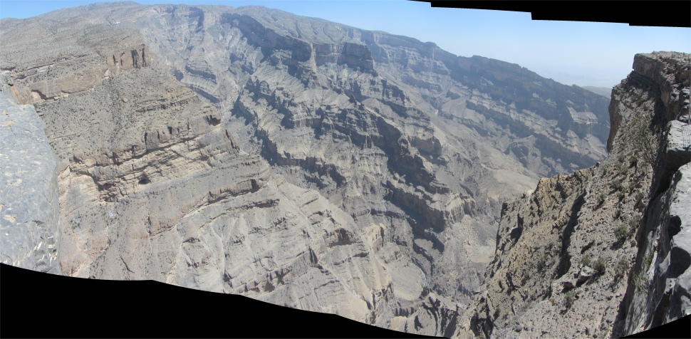
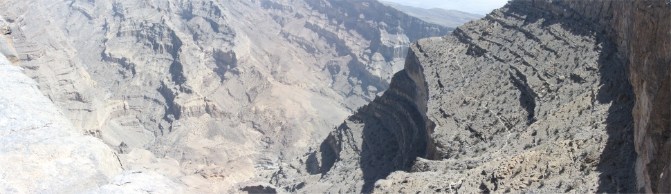
Then, we rounded a corner and wow, the view was stunning. This was the key reason why people came all the way up to Jebel Shams (Mountain of the Sun). There stretched below was the Wadi Ghul, the Grand Canyon of Arabia, and the source of the wadi I had seen at the village of Ghul. The empty slopes of the Hajar Mountains soared up towards the vast cerulean sky, and here 1000m high cliffs cascaded down from the rims to a narrow canyon floor far below.
Wadi Ghul or Grand Canyon
|
Another View of Wadi Ghul with a Settlement Far Below
|
The stunning view immediately evoked memories of
Arizona's Grand Canyon. The Wadi Ghul was nowhere near as long, wide or deep as the Grand Canyon, but nevertheless it was barren, wild, and truly spectacular. Arizona's Canyon took 6 million years in its formation; that's how long it took the mighty Colorado River to carve it out of solid rock. Here, apart from when it rains, there is only a trickle on the canyon floor, so I was deeply intrigued to how it was formed, and over what time span. The colour here was a fairly uniform slate-grey all the way down. This mountain range heaved into existence some 60-100 million years ago when Earth movements forced the Eurasian plate over the Arabian plate. Rocks formed deep within the Earth's mantle (ophiolites), deep sea limestones and other sediments now lay hundreds of metres above sea level. There, opposite me, rising 3,075m high, soared Jebel Shams, the highest part of a range which extends unbroken for 640km from the Persian Gulf to the Indian Ocean. A military radar station was based on its summit, rendering it out of bounds. The air was different up here, as clear as a glass of water; a light sweet breeze brushed my face. Round us was a silence in which only the winds played, and a cleaness which was infinitely remote from the world of men.
Sap Bani Khamis at Head of Wadi Ghul
|
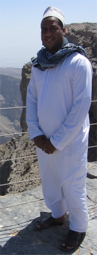
Abdullah
|
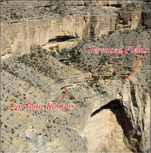
The head of the canyon ended abruptly at a rock face. Here, the high plain dropped vertically 30m down an upper cliff to a slope of debris. A spring emanated from the bedding plane at the foot of upper cliff, and flowed over small ledges down the debris before cascading over the main limestone overhang for hundreds of metres to the canyon floor. The highlight of this spectacle was the village of Sap Bani Khamis, crouched in the debris zone under a small overhang left of the stream, with carefully crafted field terraces to the right of the stream. Sap Bani Khamis was the ultimate defensive site, established when there was almost perpetual fighting between neighbouring village tribes. It once held about 15 families, and the last moved out just 30 years ago, in favour of a more relaxing environment.
On the rim where we were standing, girls stood in a shelter selling striped red and black goat-hair rugs. Apparently, the girls lived in buildings on the canyon floor, and would make the perilous journey up to the rim in order to work and sleep in the shelter for two days, before returning down to the floor while they were replaced by another group of girls. Abdullah looked over the rim's edge and pointed out the buildings where they lived and wove their wares.
We proceeded along the canyon rim taking in various viewpoints, Abdullah constantly checking for scorpions and snakes. He had a deep phobia for these creatures. At one viewpoint, a narrow trail could be seen weaving its way down to the canyon floor. Abdullah had once hiked down and it had taken him six hours to descend and much longer to climb back up.
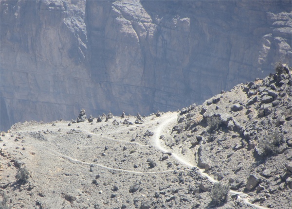
Tombs by Trail to Wadi Ghul Floor
|
Having had our fill of this wondrous sight, we started the long and winding road back down towards the coast through great coffee-coloured wastes of nothingness and then, suddenly, a house or a village, or a gentle curve of palms, their green leaves shockingly vivid against the pallid backdrop, tracing the banks of a wadi, or dry river bed. On the way down Abdullah mentioned he had a special surprise for me. As we swung off the road and pulled in to a car park, I guessed it could be surprise time. Next to us stood a bird tower, a form of giant stone dove-cote, now deserted by the migratory birds. However, the piece de resistance lay below in front of me. There at the foot of the Hajar Mountains nestled Al-Hamara. A broad oasis of date palms ran down a wadi, and immediately behind it sat one of the oldest villages in Oman. A row of deserted well-preserved two- and three-storey mud-brick houses, built in Yemeni style, abutted the palms. Behind them stood more modern houses that now formed the modern village of Al-Hamara.
When Abdullah first told me it was Al-Hamara, I twigged immediately why he wanted to show me his special place. On our way up to Nizwa he told me his family came from Al-Hamara, and they still had a family home here which they visited regularly. His grandfather still lived here, and his ancestors had once lived in the old mud-brick houses. I could tell he was quite moved in showing me this place so close to his heart.
Two wells served the oasis. The 2000+ large swathe of date palms was equally shared out between the residents.