 Re-entering the Oosterschelde in the Morning Light |
One by one, more bleary-eyed, intrepid sailors raised their heads above their cockpits. I fell into conversation with the Dutch chap from the boat in front. "Have you been to the Deltaworks Expo at Neeltje Jans?" I asked him, hoping to gain an opinion on how good it was. "I have never been there. In fact I have never been to the far end of the Oosterschelde before," was his disappointing answer. His boat was immaculate, varnished to within an inch of its life. The chap gave us a gentle push off as we cast off our mooring lines in order to catch the 9am opening of the ring bridge. We were drowned in smiles and "Tot ziens" by the chap and his wife as we slowly swung out from our berth and headed towards the bridge. The Dutch are a kind, helpful, happy race.
 Inside the Dark Depths of the Krammersluizen |
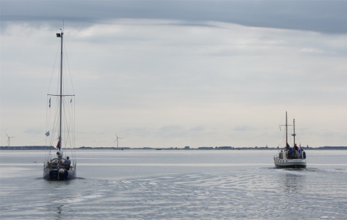
There was plenty of commercial traffic in this stretch of water, large barges steaming away with a purpose. Numerous pleasure craft and the odd stationary vessel brimming with fishermen turned it all into an ad-hoc regatta. We weaved our way through hidden channels, and took the opportunity to do some sailing when a breeze piped up. Wind turbines rotated lazily in the almost still airs.
Soon we were passing through the Krammersluizen, which separates the salt water of the Oosterschelde from the fresh water of the Volkerak. The locks were part of the Deltaworks project and officially opened in 1987. The locks for inland shipping are 280 meters long and 24 meters wide, so they are suitable for large pushers. A second lock for pleasure craft was opened in 1994. Because of the need to prevent an exchange taking place between fresh water and salt water, the locks are technically complicated. The locks are therefore designed so that no salt water flows into the Volkerak and just a small amount of fresh water enters the Oosterschelde. The operation simply applies a fundamental law of physics, denser salt water sinks to the bottom of a lock while the less dense fresh water floats on top. By deploying a complex system of pipes and pumps, salt water from below is pumped out, or from above fresh water is pumped out, depending on the destination of the ship.
We slipped out into the Volkerak and enjoyed a superb sail up the channel, pestered only by packs of large barges. A white smudge along the shore revealed itself to be a very large lamentation of swans in the shallows. Skeins of geese skimmed over the blue water that sparkled in the sunlight. The wind came in gusts, occasionally pushing us at over four knots over the ground. Of course, with the fresh water we now suffered from clouds of small flies.
 Waiting for the Volkerak Sluis to Open |
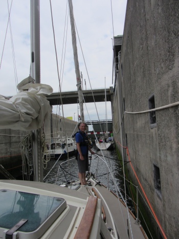
At the eastern end of the Volkerak, the Volkerak Sluis allowed us access to the Nieuw Hollands Diep. The first two inland locks were put into operation in 1967. It soon proved to be of insufficient capacity, with long waiting times as a result. In 1977 the complex was expanded with an additional lock for inland and a separate recreation lock for yachts. In addition, even an inlet sluice constructed. The waterway is an important link in the Scheldt-Rhine Canal, providing the only shipping route between Rotterdam, Antwerp and Germany. The locks are the largest inland locks in Europe and on the basis of passing tonnage (over about 240 million tonnes), the largest inland locks in the world. We were now becoming quite proficient at passing through locks, this being the seventh on this trip alone.
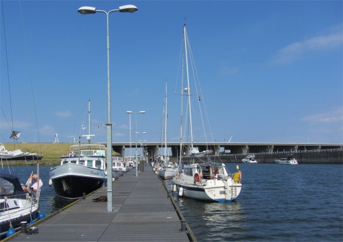
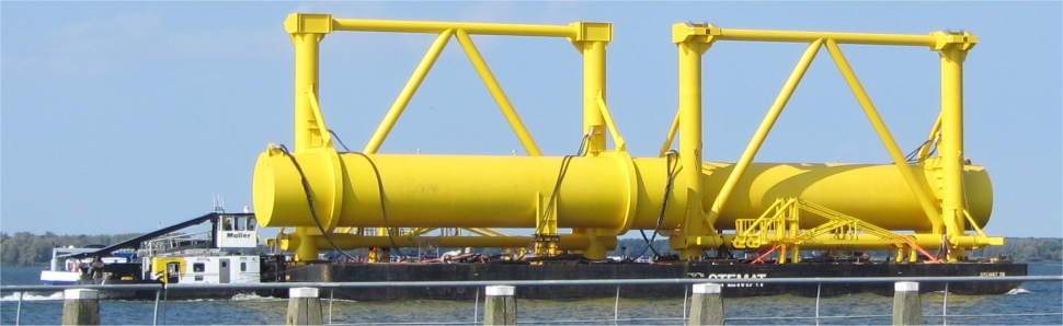
Once in the Diep, a glance over our port side revealed the Haringvliet stretching out towards the horizon. For us, a quick turn right took us into Batterij Jachthaven in Willemstad. It was one of those large impersonal marinas, fairly busy, and with a challenging tight s-bend at the entrance. We figured out why in a short time. Wash from the constant flow of barges passing by the entrance had to be quashed somehow, though the s-bend was not totally effective. Indeed the Nieuw Hollands Diep was almost like the M25 with a constant stream of barges travelling in both directions, sometimes three abreast. A large oil refinery was located a short distance up the Diep, which explained the large number of tankers ploughing their way along the waterway.
 Large Cargo Passing by Batterij Jachthaven |
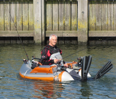 Armchair Fishing |
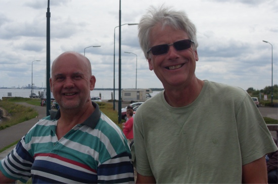 Me and Rex Looking Over the Hollands Diep |
The evening was rounded off with one of Rex's "Sorry, I Haven't a Clue" CDs, always good for light-hearted humour, and then we collapsed into sound slumbers.
22nd June
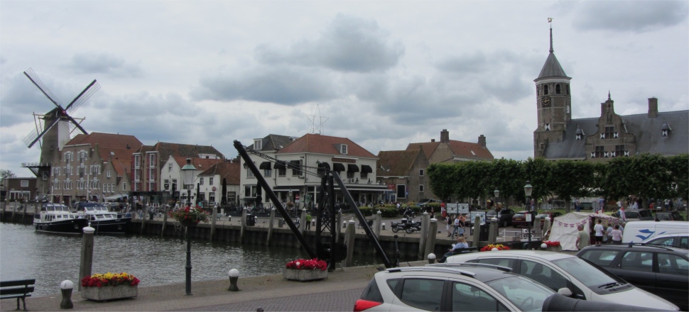
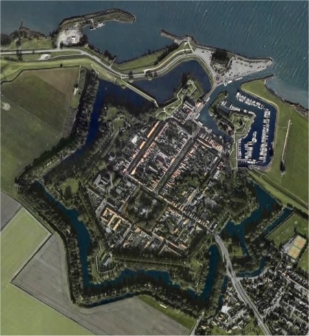 Aerial View of Willemstad. Notice the 7-Pointed Star Fortifications |
Showered, boat and passage planning checks completed, we sauntered off to discover the delights of this small, pretty town, passing all the Dutch women busy washing and polishing their boats on the way.
Willemstad was a small historical town in North Brabant, a province in the southern part of the Netherlands. It was well placed, lying on the Hollands Diep, close to the Haringvliet and Volkerak, it could control passage through these three stretches of water, hence the reason for its fortifications. The town was described as an unaffected example of 16th century fortification architecture, and as such had been placed under the care of the Dutch building preservation service.
In the midst of the sixteenth century, it was decided to create one of the last big polders in the north-east of the North Brabant province. At the end of 1564, the polder was complete and a town was founded in the extreme north-west corner of the polder. The surveyor, who fixed the ground plan, had consulted earlier ground plans which showed how towns in the provinces should be built at that time. However, for whatever reason, many towns were not built according to the original plan. Willemstad was an exception to the rule and was built to the plan as originally designed. This new town was at first named Ruigenhil (Rough Hill). The street map for Willemstad had remained the same. Since the town was strategically situated at the border of the provinces of Holland, Zeeland and North Brabant and at the confluence of three waterways, in 1583 it was decided to build walls around Ruigenhil. Fortification engineer, Abraham Andriesz, received orders to plan for the walls. The works were constructed line symmetrical around the old street plan. The existing access road was flanked by two bastions, and in the wall the land gate was built. Because of modern weapons, old medieval stone walls were no longer an effective protection for a town. The stone walls with towers were gradually replaced with lower earth walls, on which artillery could be placed. In the walls, at regular distances from each other, defensive works, the bastions, were built that were shoved to the outside so that the entire wall could be covered by canons and muskets. This arrangement of the bastions with five points and bended flanks was the most easy to defend. The new fortifications were completed by Adriaan Anthonisz. In the second stage, these fortifications were even expanded with two bastions outside the dykes, which were for protection of the harbour. The seven bastions were named after the seven provinces of the Dutch Republic: Groningen, Overijssel, Friesland, Utrecht, Zeeland, Holland and Gelderland. The net result was a town completely surrounded by a city wall in the shape of a 7-pointed star completely surrounded by two concentric "canals", one of the most attractive examples of the old Dutch system. In 1584, the town of Ruigenhil was granted to William of Orange and from then on was called Willemstad (William's Town). The town received city rights in 1585, but to me it was still a very small town.
 Binnenhaven |
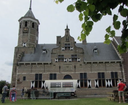 Stadhuis |
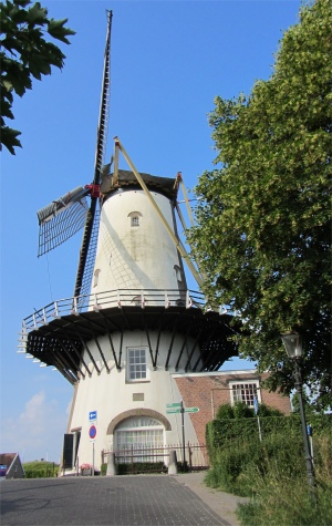 d' Orangemolen |
A large formal looking rectangular building stood a short distance past the gatehouse, Het Arsenaal (the arsenal), a reminder that this was a fortified town. Ordered by Napoleon, Het Arsenaal housed a small detachment of French (and later Dutch) soldiers, as well as their armoury.
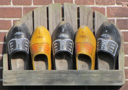 Missing Clog? |
Walking by the Binnenhaven with Rex admiring the boats, we headed up a slight incline and passed the d'Orangemolen (of orange windmill, I guess a reference to William of Orange). Behind it we discovered another yacht harbour, much smaller than the Batterij Jachthaven, and probably cheaper. We said we'd bear this in mind if we had to stop here again.
It was from here that we picked up a path that traced the top of the old fortifications, and skirted the Gracht or moat that surrounded the town. We meandered around Bastion Overijssel. Like many of the bastions, evidence of military activities still survived, such as old canons. And, as with a lot of the Netherlands, signs of military occupation from more recent times were visible; the same bastions had been converted into bunkers by the Germans during World War II.
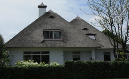 Thatched Roofs |
We strode down through leafy suburbs, passing beautiful houses in front of which neat, manicured gardens reigned supreme. One bungalow even had a close-cropped thatch roof. Was it combed daily? The ditch that hugged the road was home to a pair of moorhens with their four young, and a swan with eight signets. Soon we were out in the pancake-flat countryside walking past fields full of wheat and potatoes. Cyclists after cyclists passed by, none wearing helmets, and none ringing bells. Rex always kept an eye out for me and yanked me out of the way when these velocipedrics shot by. He would then replace his eye. Apart from a single jogger, we were the only people walking.
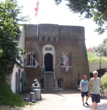 Fort de Hel |
Reaching a small rise in the dyke, we strolled up it and found it advertised as Fort de Hel. In 1748 this fortification was built of earth - a battery to support and defend Willemstad. It was part of the Southern Water Line, the historic Southern Frontier, which ran from Zeeland Sluis Grave to Nijmegen. This defensive frontier comprised a series of fortified towns, forts, redoubts and flood plains. In 1812 Lodewijk Napoleon ordered an expansion of a brick tower, complete with platform for cannons. The fort was now a protected cultural monument. From early 1994 the fort had been hired from Willemstad to the Friends of Fort Hell Foundation, whose purpose was to restore and maintain the fort. What remains of the old fort was the original earthen hill fortification with the brick tower. A small moat lay just to the north of the hill. A sizeable chunk of land was attached to the fort. This had a zip wire over a pond, part of an activity service they offered, together with an archery range. The rest of the land was peppered with an assortment of odd looking military artefacts, and a plentiful supply of multi-coloured mock rockets, all rather peculiar.
 Koepelkerk |
Whilst sipping our drinks, the young lass came over to us, presumably to chat. We soon discovered that our Dutch was better than her English; very odd for a country where most youngsters speak fluent English. The old couple, who were Dutch, then quizzed her over her lack of ability to speak English. "Did you not learn English at school?" they asked her. "Yes, but I have forgotten," she explained. The old couple seemed deeply insulted that their fellow country man, or should that be country girl, could not converse in English, shrugging their shoulders and shaking their heads. Blimey, you'd never find that situation occurring in Britain.
Coming across a wardrobe of old uniforms and hats in the cellar, I donned an outfit, took up a musket, and took the fort single-handedly. No competition really.
A shortcut across the fields got us back to Willemstad far quicker than it took to get there, and there were no cyclists to contend with, just a motorist who stopped to ask me if he was travelling in the right direction to reach the Volkeraksluizen. I confirmed it was in my best Dutch, and he happily carried on.
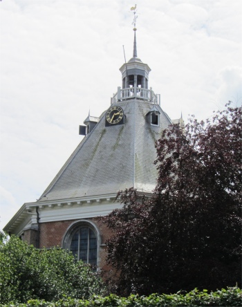
The d'Orangemolen was now rotating, and the Koepelkerk (domed church) was busy with a children's art exhibition. The octagonal plan church was surrounded by a shady cemetery which itself was surrounded by a ditch. Its construction was finished in 1607. This was the first Protestant church in the Netherlands. It was not an enormous church with a huge tower, nor was it cross-shaped and had no fine sculpture-work surrounding it. It was simply a house of prayer, without any distractive items. If we had carried on along Hofstraat, we would have come across the Mauritshuis, but we turned up Voorstraat instead, the main thoroughfare in the town.
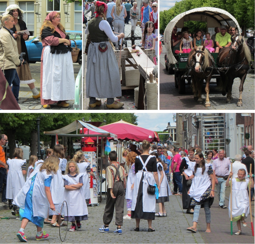 Sunday Fair |
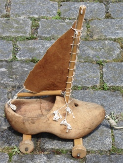 Sailing Clog |
We had a pleasant evening in a local hostelry near the town hall. Rex had ordered his meal in impeccable Dutch as usual, and the waitress just smiled at him and replied in English. We fell into conversation with the couple on the next table. The man, a charming character, urged us to spend all our money in the Netherlands while we were here. The Dutch have a wicked sense of humour.
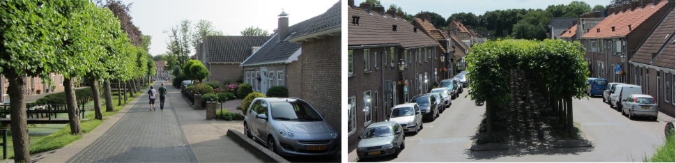 Streets of Willemstad |